Dream City

On 12 September 1965, shortly after Singapore had been cast out of the recently formed Malaysian federation, and had declared its independence, the fledgling nation’s prime minister Lee Kuan Yew stood before a crowd of supporters and declared, “We made this country. From nothing! From mudflats! Ten years from now, [Singapore] will be a metropolis. Never fear!”


By any yardstick, it was a bold prediction to make. Granted, 150 years of British colonial rule had created a thriving entrepôt based around the port, a first-rate civil service, and a picturesque skyline of neoclassical and art deco piles clustered around a central business district on the southern tip of the island. But outside this area were mudflats and swamps, and dirt-poor kampong villages. Most of the population lived in squalid, crowded tenements. There was no reliable water supply. In real terms, the average Singaporean in 1959 was as poor as the average American in 1860. Against this sobering background – a metropolis in a decade?


In 1975, I was still a child; but now, looking back through my family’s photograph albums, I see the clear outline of a city in mid-transformation. By that time, most of the kampongs had disappeared, and my family lived in a two-story colonial-era terrace house on Emerald Hill Road, just off Orchard Road. Day and night, there was always the pounding noise of construction – the buzz of a city tearing itself apart and recreating itself.


I come across a photo of a relative standing proudly at his balcony in one of the fancy new condominiums that were sprouting up all over the island. And here’s one of me and my mother standing on Orchard Road, against a backdrop of Christmas lights, smiling brightly at the future. As a treat, we would visit my uncle in his office in Raffles Place – then, as now, the city’s Central Business District – with its mix of gleaming new skyscrapers, art deco piles and 19th-century shop-houses along Boat Quay. In all the photos, everything looks bright and shiny. If there were any mudflats or swamps, I don’t remember them.


For almost without anyone noticing, Lee had actually achieved a metropolis in a decade. He was bang on schedule. Admittedly, no one pretended that Singapore was anything like New York or London, but it certainly wasn’t a hardship posting either. What not many of us realized at the time was just how fast the wheels were turning behind the scenes, and how hard Lee was pressing his foot on the accelerator.


Almost immediately after that landmark 1965 speech, he had set about rehousing the population. The surest way to create a sense of identity, and for ordinary Singaporeans to accumulate wealth, he felt, was to give them a home of their own. Ownership grounded people. So he put in place sweeping new zoning laws. Entire neighborhoods of grim tenements were razed. In their place rose rows of utilitarian public housing blocks that have become a familiar part of Singapore’s modern skyline. By 1970, the housing problem was, in the government’s own memorable parlance, “licked”.


Meanwhile, the island was transforming itself into a commercial and logistics hub, luring both business and human capital with attractive incentives and tax breaks. New buildings were springing up everywhere, though Lee was careful to intersperse all this dizzying renovation with large-scale botanical projects. So much so that today nearly half of Singapore is green space. By the time the new millennium swung around, Singapore had achieved First World status in less than two generations.


Today, the skyline continues to morph at an astonishing speed, but beneath the 21st-century gloss, old Singapore still pulses. In 1995, Lee offered a canny stock-take of the symbiosis between commerce, Singapore’s modern built landscape and its past: “We made our share of mistakes… [In] our rush to rebuild Singapore, we knocked down many old and quaint Singapore buildings. Then we realized we were destroying a valuable part of our cultural heritage… we were demolishing what tourists found attractive and unique in Singapore. We halted the demolition… The value of these areas in architectural, cultural and tourism terms cannot be quantified only in dollars and cents. We were a little late, but fortunately we have retained enough of our history to remind ourselves and tourists of our past.”


That past is why I like to walk in Singapore. I love wandering through Little India, Kampong Glam and Chinatown for their cacophony of sounds, music and chatter; their temples and markets; and their narrow alleys lined with period architecture – all remarkably intact nearly 200 years after Stamford Raffles, the founder of modern Singapore, first demarcated these quarters for the diasporas of Indians, Malays and Chinese.


But it’s the area around Raffles Place that I love the most. Whenever overseas guests ask me where they should start their tour of Singapore, I bring them to the middle of Boat Quay’s Cavenagh Bridge. From this graceful cast-iron suspension bridge, opened in 1870, the island’s past and future segue into an extraordinary skyline. Though the sleek, gleaming skyscrapers with their soaring steel-and-glass frames dominate the horizon, the greater pleasures, for me, are to be found in the older, lower-slung silhouettes that hug the east and west banks of the Singapore River.


Here, in the shadow of towers built by IM Pei and Kenzo Tange, is the same stretch of multi-hued shop-houses I remember from my childhood. Hugging the curve of the Singapore River, these narrow 19th-century buildings – once shops, warehouses, offices and homes for the coolies and businessmen who made their fortunes from the trading barges that docked here – have been converted into lively pubs, cafés and restaurants.


And just across the river, the imposing civic offices of the old colonial British administration have been meticulously restored and repurposed into the Asian Civilizations Museum, soigné eateries and drama centers, alongside the mid-19th-century Victoria Theatre and Concert Hall.


I walk another block north to take in the neoclassical glory of the early 20th-century Supreme Court and City Hall buildings, which were made over in 2015 by the Paris-based Studio Milou into the National Gallery Singapore. The bones of the original interior spaces – the old courtrooms, public corridors, and timber-paneled judges’ chambers – have been preserved as a sequence of generously proportioned gallery spaces that house the world’s largest collection of southeast Asian contemporary art.


And just beyond the Padang – the city’s central playing field – is Marina Bay. When I was growing up, the waterfront was a hive of sampans (traditional Chinese wooden boats). Today, its eastern flank has been enclosed by a new Central Business District, the futuristic biodomes of Gardens by the Bay, and the Marina Bay Sands casino and resort. From the Padang, I like to walk on towards St Andrew’s Road. Two hundred years ago, this was a bucolic stretch of pastoral land framed by dirt tracks and orchards. In 1835, GD Coleman, the Englishman responsible for so many of Singapore’s early colonial buildings, built St Andrew’s Cathedral in an early English Gothic style with a softly glowing white façade made of shell lime, egg white, sugar and water from soaked coconut husks.


Though St Andrew’s Road is now a busy thoroughfare, Coleman’s masterpiece – with its elegant interior of fine filigree plasterwork – remains one of my favorite quiet spots in Singapore. Stand in front the National Gallery, I tell out-of-town guests, and look out over the green expanse of the Padang. On weekends, the field – book-ended by two of Singapore’s oldest private clubs, the Singapore Cricket Club, which was founded in 1852, and the Singapore Recreation Club, founded in 1883 – echoes to the whistles and cries of a rugby match, and the baritone whack of cricket balls.


But, as with so many places in Singapore today, there is a less bucolic palimpsest. In 1942, during the Japanese occupation of Singapore, Singaporean and British civilians were rounded up here before being taken to the notorious POW camp in Changi in the eastern corner of the island. Three years later, Lord Louis Mountbatten stood on the grand steps of City Hall and accepted the official Japanese surrender from General Itagaki. And in 1959, the newly elected prime minister Lee Kuan Yew chose those same steps – this time, facing a Padang filled with celebrating locals – to declare Singapore’s independence from Great Britain.


When Lee died in 2015 at 91, long lines of Singaporeans crisscrossed the Padang and along the Esplanade all the way to Parliament House where he lay in state. Almost half a million people stood in the searing heat and into the night – some for as long as ten hours – to pay their respects to the man who had dominated every aspect of modern Singapore. On the day of the state funeral, 100,000 mourners jammed the route of the cortege, soaked to their skins in the heavy tropical rain. The sense of loss was palpable.


Later, someone said on Facebook: “It was really something to be a part of. It was the Singapore zeitgeist, both on that historic field and online, for a long crowded night at the end of a stirring week. But I think we’ll be OK.” I couldn’t help thinking not many people would bet against that prediction.


Your address: The St. Regis Singapore
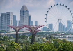
 

NGS Picture Id:1511612


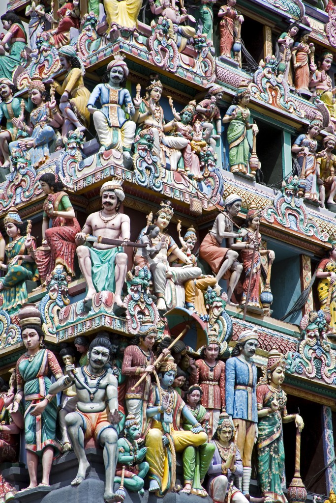
Detail from Sri Mariamman Hindu Temple

(© National Geographic Creative)

Sands of Time

Travel and the Middle East were made for one another. Over the centuries – and no region on earth this side of Africa has been around for so many of them – the land has been criss-crossed by Nabateans, Romans, Crusaders and pilgrims. Its dunes and deserts have enticed writers and wanderers, from Victorian explorer Sir Richard Burton to TE Lawrence (better known as Lawrence of Arabia), while its Byzantine mosaics are still points of pilgrimage for modern travelers.


Having only ever studied Jordan – as Edom – during the course of a theology degree back in the mists of the 1980s, I thought it was high time I joined the caravan of explorers, mystics, dreamers and divines. They went on foot and by camel. I used these too, and a horse, and a nice, comfortable, air-conditioned 4WD. My mission: to see the ancient – and to arrive at the modern, and make contemporary sense of these biblical lands.


I crossed the Allenby Bridge from the West Bank behind buses heading to Mecca. Behind me, Jericho; beneath me, the River Jordan; a little way along on my right, Mount Nebo, from which Moses was allowed a view of the Promised Land. Not bad for a start. From here, the Jordanian river Kazem followed the magnificently dubbed though meandering King’s Highway south, following the contours of the Dead Sea Rift. At Madaba, I saw a large fragment of a map of the Holy Land made for an unknown Christian community in the 6th century. Jerusalem, Bethlehem, the Dead Sea and Nile Delta were all clearly depicted. What could be more stirring to a travel writer than an exquisite map, laid out on the floor of the Byzantine Church of Saint George, linking faith with landmarks and long journeys?
 

We traveled slowly for 220 miles all the way down to Wadi Rum, passing through arid plains and desert canyons. I saw few major towns and no cities, but plenty of shepherds and goatherds, donkeys and camels, as well as numerous Bedouin encampments. The land was parched and bleak. But wherever a trickle of water persisted, crimson poppies and black lilies – Jordan’s national flower – had burst through the dun crust.


I saw an old steam train left sleeping on the Hejaz railway at Wadi Rum – a southern, narrow-gauge spur of the old Orient Express. Here my path diverged from the great thoroughfares of Arabia as I made for a tented camp at the foot of a sandstone massif. A hot towel and fresh pomegranate juice awaited, as well as a basic if spacious Bedouin tent. Set amid a maze of monolithic rocks, this was to be my home for three nights; the first one began with a beautiful moon and a delicious barbecued lamb and meze supper around an open fire.
 

Deserts are utterly formless at first, and it takes time to get your bearings. A dawn drive in a sturdy 4WD took me first to a row of towering peaks nicknamed the Seven Pillars of Wisdom after the book of that name by TE Lawrence. There were no roads, but the driver-cum-guide followed ruts in the sand, which took us to high viewpoints, down through broad Martian valleys and into narrow natural cuttings dotted with tiny oases.


In the morning the heat was mild enough to set on short solitary walks. My drivers had the good sense to give me space and time to enjoy the silence, the surreal rockscapes and the play of the light on the mountains. I hiked to see the low-slung redbrick ruins of a Nabatean temple dating from the first or second century AD. The Nabateans were an Arab people who spoke a language related to Aramaic – Jesus’ native tongue – and ran a large trading network across the Levant. As well as inscriptions in their own language, Latin writing has been identified on an altar while marble columns were overlaid with graffiti in a poorly understood proto-Arabic tongue known as Thamudic.


From such sites sprung many European languages, as well as the fundamentals of Western culture. The temple is believed to contain remnants from the 14th century BC, when it was dedicated to two Mesopotamian deities: Hadad, the god of thunder and rain, and Atargatis, goddess of fertility, fruit and foliage. Standing behind one of the low walls and looking out over a plain littered with rocks and tufts of dry grass, I could imagine generations of locals looking up to the cloudless sky, yearning for rain and a few green shoots to feed a goat or camel.


But, lo and behold, just a little way along from the temple were springs bursting from the ground, framed by mint bushes. Close by was another waterhole shaded by green-leaved trees and ferns. In his Seven Pillars, Lawrence recalls pausing here to “taste at last a freshness of moving air and water against my tired skin. It was deliciously cool.


It was indeed, but there was so much else to see. I walked up to an outcrop, and then through another narrow wadi – or ravine – dotted with more pools, before joining the driver and continuing on to the Canyons of Umm Ishrin – the “Mother of Twenty”, supposedly named for 20 Bedouins killed on the mountain, or a mad, bad woman who killed 19 suitors before settling on the twentieth. On several rocks I saw depictions of Lawrence of Arabia, looking suspiciously like Peter O’Toole. Fittingly, the passage of the archaeologist-cum-military man-cum diplomat through these parts is largely shrouded in mystery.


Camels and hot tea welcomed me back to the tented camp, where I was able to shower and sit back and take in the deep peace and the huge dome of the darkening sky. There was electricity, hot water and beer, and my tent had a ceiling, but it still felt right to be in the desert. Little wonder that the most famous book in Arabian history is dedicated to the night – or that dreams figure so prominently in the region’s legends.


The canyons and ravines of Wadi Rum shaped only by weather and age, are a sort of divine overture for my next stop, Petra, where human craft has taken the raw material of sandstone and created one of the world’s true wonders. Desert travelers like to invoke Shelley’s Ozymandias. Well, Petra is an antidote to the expectation of decay. Where there might have been ruins and the scattered sands of time is truly spectacular architecture, carved out of the rocks – or perhaps “into” is more accurate. For this famous city, built as early as the 4th century BCE as Raqmu, the capital of the Nabeatean world, is like the imprint of a powerful imagination that saw shapes where others saw only cliff walls and untidy lumps of dead rock.


The path into the site, known as the Siq or “shaft”, follows a narrow, winding gorge through towering rocks. At times it’s barely ten feet wide, and is narrower at the top than the bottom; as you step from shadow into light, and then back into the murk again, it feels as if it was built for theatrical, rather than defensive, purposes.


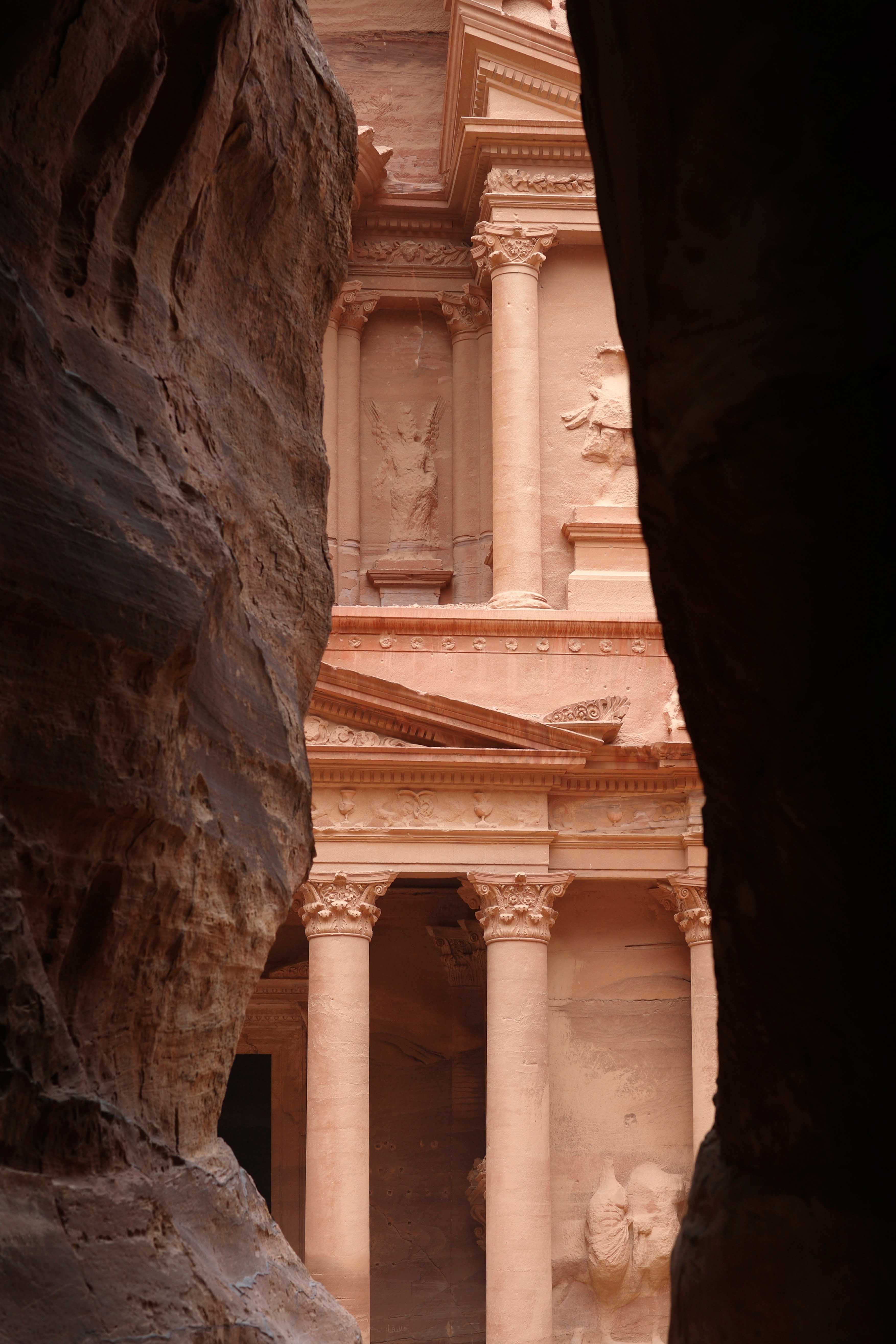
On exiting the cleft – a geological fault smoothed by water – you meet with Petra’s stunning centerpiece: the Treasury, or Al-Khazneh in Arabic. You might know the colonnaded Greek-influenced facade from its appearance in the 1989 film Indiana Jones and the Last Crusade. The name refers to a local legend that bandits hid their loot in a stone urn placed high on the upper level. But the building was originally built as a mausoleum and crypt. The wind and seasonal rains have eroded many details but archaeologists have located mythological figures representing the afterlife, as well as dancing Amazons with double axes, and Castor and Pollux (twin brothers from Greek and Roman mythology).


Pliny wrote of Petra’s importance as a trading crossroads. As I walked on to visit dozens of rock-cut tombs, temples and a Roman-style theatre – the Romans occupied the site from 64-3 BCE – I began to get some sense of just how big and permanent, not to mention affluent, it must have seemed to its original residents and travel-weary visitors. Under the noonday sun, the 800 steps up to the Ad-Deir Monastery were slow going but at the top was another beautiful classical facade. Once it would have been a major crossroads linking China with Rome. On the main colonnaded street there was space to think and wonder: for centuries, caravans laden with silk, spices, incense and other exotic wares could be stored and animals rested safely here. Once a tax was paid, the merchants were free to continue their journey west or east.


Though UNESCO-listed Petra receives some 500,000 visitors a year, making it Jordan’s number-one visitor attraction, it’s expansive enough not to feel cramped. Once you’ve seen the major architectural landmarks, your gaze falls on shadows, caves, crevasses and windows offered by rocks that afford surprising vistas over the complex. Too many people rush through; I’d recommend a morning and then a late afternoon, to see how the sun works its own wonders on the sandy rock. You can easily escape the hubbub and the donkey-ride sellers, and there are several cafés and a restaurant serving delicious falafels. You can even pop back after dark for Petra At Night, when thousands of candles are lit in front of the Treasury for a session of music and storytelling.


Over the course of their long stewardship, the Romans diverted most of their lucrative trade routes away from Petra. That’s one of the main reasons it was overlooked even during the age of the Grand Tour. The site celebrated the 200th anniversary of its rediscovery – by Swiss explorer Johann Burckhardt – in 2012. Those two centuries saw seismic political shifts across the Middle East and the establishment of many new nation states from former tribal territories. Jordan, which became a British protectorate and then gained its full independence in 1948 as the Hashemite Kingdom of Transjordan (shortened to Jordan the following year) is one of these.


The drive from the ancient capital of the Nabatean empire to its modern capital, Amman, takes only three hours on Highway 15 – the main trunk road. The city sits in a deep bowl, its residential neighborhoods of cream-colored blocks spread over the slopes, with the main commercial centers along the lower reaches. More than four million people live in the fast-growing city (there were only about 5,000 in the 1920s), and the expanding sprawl now stretching over 19 hills, with many suburbs hidden behind the high ridges.


Amman lies close to ’Ain Ghazal, one of the oldest settlements in the near east, and stands on the site of the Greek city of Philadelphia (meaning “brotherly love”. As a Beta city on the global index, a cosmopolitan and liberal cultural center, an important banking hub, and a tourist destination popular with Arab and European travelers, it has risen to prominence with remarkable speed.


The best overview by some way is from the Citadel, a collection of Roman, Byzantine and Umayyad ruins that sits at the top of the city’s highest hill, Jebel Al Qala’a. The most significant extant structures are the 2nd century Temple of Hercules and partially reconstructed Umayyad Palace, but the poetry resides in the juxtaposition of ancient columns, podiums and arches – which act as a series of frames – and the modern apartment blocks beyond. A wonderful breeze made a walk around here late in the afternoon especially pleasant, and as there were only two dozen visitors spread around the extensive site, I could easily find tranquil spots to sit and stare. As at the Tels of Palestine, you have a strong sense of being on top of layered history, of belief systems and world-views that come and go. The feeling was compounded when I had one of those rare epiphany-like travel experiences – when the call to prayer commenced around the city, and live voices and recorded ones overlapped and echoed all around the valley.


There are regular evening festivals and concerts at the Citadel. As they’re the only way to see the site, and those views, after dusk, keep an eye out in the local listings via your concierge.


Down below is a hillside amphitheater from the same period as the temple. But I was ready for some 21st century city life. In Amman, there’s plenty of this, from the American-style eateries, power lunch and realpoliticking rendezvous of the western hotel districts, to the slick coffee shops and trendy bookstores of Rainbow Street, to the throbbing heart of downtown, where you can take your pick between old markets, traditional food stalls – Jordanian beef and pasta, bean dishes and fresh khubz breads are classics of Levantine cuisine – and street traders pulling carts loaded with olives, tomatoes, peppers and fresh juices. At times, its energy reminded me of Cairo, but it’s far less hectic and less dusty. It’s also untouched by mass tourism, a rare thing in a major capital.


The local Carakale microbrewery claims the Sumerians invented beer some 5,000 years ago and it is merely bringing it home. Around Darat al Funun, I found a fabulous contemporary art space. These are not the delights one expects to discover in an Arabian city. In the new Abdali district, two million square meters of office space are being developed to transform Amman, a safe and strategically important city, into a business hub. The blurb declares the project’s aims of “catapulting Amman into the 21st century and placing it on a par with most of the world’s renowned city centers”. Well, from Petra we know what happens to those in the end – but right now, Amman, and Jordan are happening and hopeful.


Your address: The St. Regis Amman


4709900206


At the end of a narrow gorge, hewn into sandstone cliffs, stands Petra's most elaborate ruin, Al Khazneh, known as The Treasury

(© Aurora Photos)


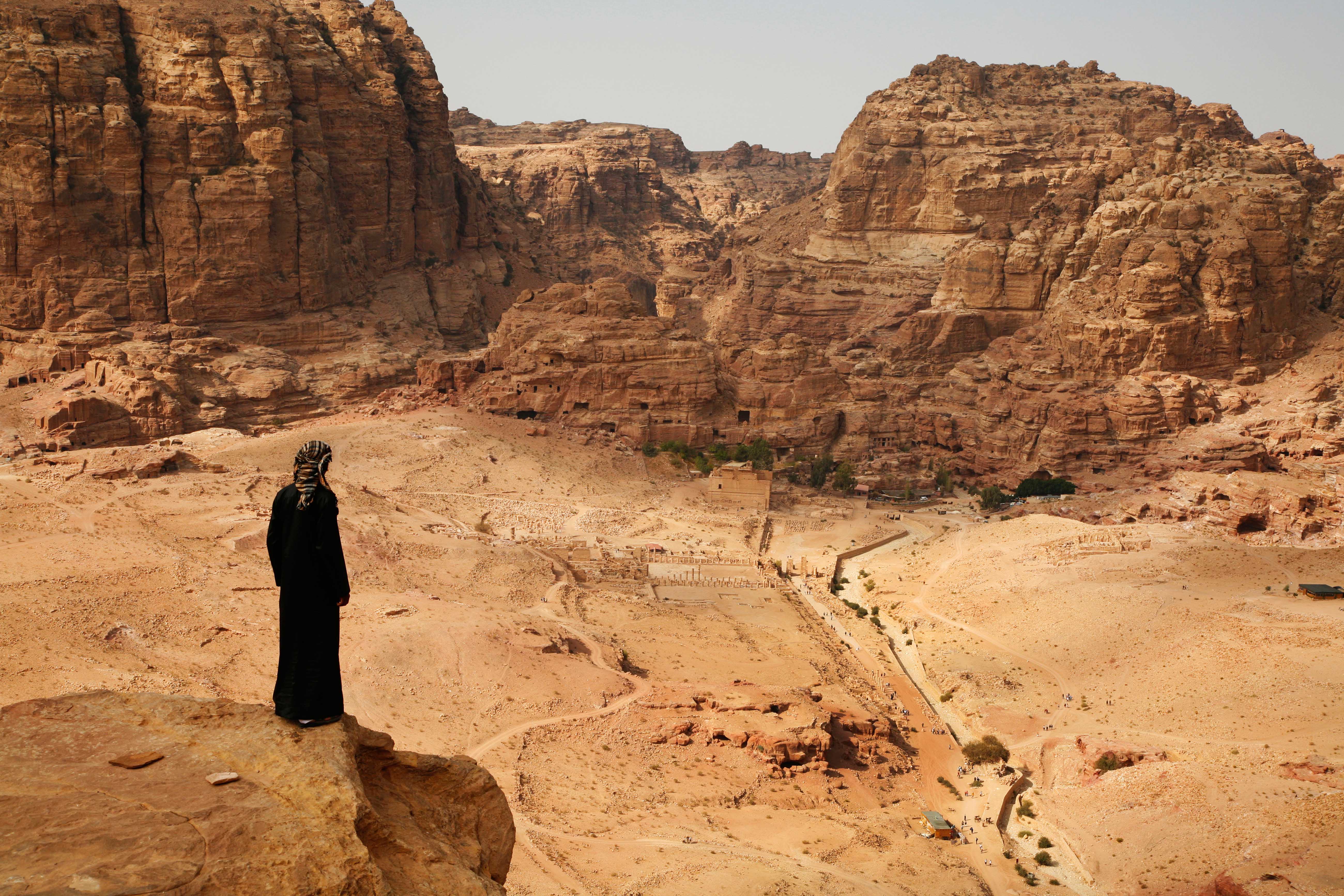
Bedouin man in Petra, Jordan.


Looking out over Petra 

(© Aurora Photos)


The Road More Traveled

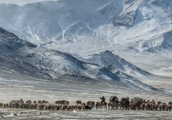
In the Tian Shan Mountains – the Mountains of Heaven, to the Chinese – my guide and I came upon an old man on a white horse. He wore tall leather boots and a splendid white felt hat like an upturned jelly mold. With a jerk of his head, he invited us to come and eat. Beyond San Tash, where Tamerlane left a chilling monument to his slaughtered dead, we found his yurt perched on a bluff above a dark river. Full of the aromas of cooking and wood smoke, it was as snug as a womb. We took our place sprawled on rugs on a raised platform at the rear. Bowls of milky tea laced with butter were handed round and a great plate of petrified cheese was set before us.


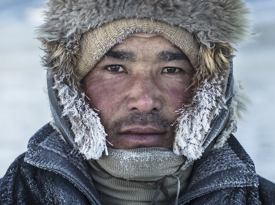
The old man’s flat Kyrgyz face was the color of walnuts. He gazed at me for a moment without speaking, as if assessing my fate. Then he set about eating, chomping his way through the bread and cheese with a series of deep, throaty growls, before throwing himself back onto the pillows with a grunt and looking at me. “ENGLISH!” he bellowed at me. (I’m not English, but this didn’t seem the moment to quibble about passport details.) “ENGLISH, WHERE IS YOUR WIFE?”


I thought for a dreadful moment he knew something about my wife that I didn’t, that he had heard she had run away to the South of France with a member of the Chippendales. Then I remembered I didn’t have a wife.


“No wife,” I said, relieved.


He made a pantomime expression of surprise. His eyes, the color of tea, widened to the size of saucers.


“NO WIFE?” he bawled. Then his voice dropped to pianissimo. “Listen carefully, English. Let me tell you how to get a wife.” And leaning back, he embarked upon an explanation of the intricacies of Kyrgyz romance.


I was on the Silk Road, that great trans-Asian route that the English traveler Freya Stark described as “the oldest, the longest, the most romantic, the most persistent of all the checkered streams of trade”. For more than 4,000 miles, it follows various routes from the gates of Xi’an in China to the shores of the Mediterranean. But whichever way you pass, Central Asia is its hub, and the people of Central Asia its middlemen. They share nomadic roots, mercantile instincts and a surprising enthusiasm for splendid hats, from the dainty pillbox job of the Uzbek merchant to the tall felt affair of the Kyrgyz horseman.


I had come to Central Asia to understand nomads, and to see the remnants of the nomadic culture that still existed in the remoter regions of Kazakhstan and Kyrgyzstan. I was following the route of the old Silk Road, from the Crimea across southern Russia, watching the rolling steppes from the windows of the Kazakhstan Express. I left the train in the town of Turkestan, where dust from the Kyzylkum Desert coated the leaves of the shade trees along the main road.


Turkestan is home to one of the holiest of Kazakh shrines, the mausoleum of the first great Turkic saint, Khoja Ahmed Yasawi, the founder of a Sufi order in the 12th century. Its blue dome rises on the edge of the desert, the sole survivor of the town’s more glamorous past. It was built by one of the great names of Central Asia: Tamerlane, the 14th-century conqueror who traced his ancestry back to Genghis Khan.


The mosque encapsulates the true essence of the Silk Road. Ideas were packed among the goods in the baggage trains on this legendary route. Culture, art and religion passed from one region to another with breathtaking fluidity. Islam spread here from the Middle East – and the ribbed dome of this shrine is part of the great canon of Iranian architecture, an influence that had traveled eastward along the Silk Road for well over 600 miles. The dome hovers above walls of turquoise and azure tiles and delicate traceries of arabesque. I followed passageways from the central chamber into a labyrinth of tall white rooms, the grilled windows of which filtered the outside world to a pale wash of light and a filigree of muted sound. No other religion has captured the longing for a tranquil soul in the form of architecture as exquisitely as Islam.


To the south of Turkestan lie the ruins of Otrar, another ghost on the Silk Road, and the place where Genghis Khan, the great nomadic conqueror, got his start in the business of empire-building. Just beyond a museum cataloging the life of this once-great city, a long featureless mound topped by waves of corn, littered with pot shards and bleached bones. In an excavation pit, where swallows rose in a fluttering cloud, I found the floor of Otrar’s great mosque. All that remained were the shattered bases of brick columns. The layers of sediment exposed in the pit walls showed the strata of the city’s different eras of settlement. Among them, a thick line of ash marked the Mongol era, when Genghis Khan had sent armies to burn this city to the ground, at the very beginning of the Mongol Empire.


This conflict between the settled people of cities and the nomadic horsemen of the steppes is one of the central issues of the Silk Road. Time and again, nomads would sweep east and west along the road to conquer settled populations – in China, in Persia, in northern India. Here, in this archaeological pit, in this layer of burnt material, was a moment in history that you could touch. I raked my fingers over it, and the old ash, the ancient antipathies, crumbled onto my boots.


 Above: Registan Square, Samarkand

(©Ian Berry/Magnum)


In the congested avenues of Almaty, Kazakhstan’s former capital, I found myself sympathizing with the nomads. The city was full of city hassles – queues, crowds, traffic. In the midday heat, people seemed to move in sluggish slow motion. But when I lifted my eyes beyond the buildings and the rooftops, I could see the mighty Mountains of Heaven, the mighty Tian Shan. They promised escape.


So I set off with a guide, the bumbling Marat, to Kyrgyzstan, and that section of the old road that ran along the northern shores of Issyk-kul lake towards the mountain passes to China. In Bishkek, the Kyrgyz capital, the main avenue was still called Silk Road Street. Eastwards, the road ran through velvet foothills. Gangs of hay-makers were out in the fields with pitchforks and scythes. On the far side of a pass of poplars and rose-colored rocks, huge flocks of sheep appeared, with young shepherds on horses cracking long whips in the rolling clouds of dust.


We passed the 11th-century Burana Tower, like a lighthouse of the Silk Road, marooned in fields of edelweiss. It marked the ruins of Balasagun, a millennium ago a great Silk Road city. In the small museum were the remnants of the ancient trade: Chinese coins, bracelets of Indian cowrie shells, iron swords, bronze lamps, amulets. In the late afternoon, we came down to Issyk-kul. Its glassy surface held the reflections of snow peaks and high wind-torn clouds. A family went by in a wagon, the patriarch in a tall felt hat, reclining on bolsters of new hay among a tribe of daughters. At the end of the lake we drove through apple orchards to Karakol. Tucked away in one of the remotest corners of Central Asia, the town of Karakol still had the cosmopolitan air of a Silk Road town, a place where disparate peoples met and mingled. Blond Russian schoolchildren were trailing home past cottages with blue shutters and white picket fences. Uighurs in their pretty embroidered caps had laid out cheap Chinese imports at makeshift stalls in the main square. In the market, Uzbek butchers were dismembering cows with huge axes. Kazakh men went by on tall horses while old Kyrgyz men with wispy beards gossiped on shady street corners.


The next morning, Marat and I took up the trail of Tamerlane, heading east into the Tian Shan mountains. Born in Central Asia, Tamerlane, or Timur, was the last of the great nomadic conquerors, forging an empire in the 14th century that stretched westward along the Silk Road into Iran and much of the Middle East as well as southward into northern India and north into much of Russia. In Samarkand, his capital, he left one of the world’s most beautiful ensembles of Islamic buildings – a model of architectural delicacy and sophistication. Everywhere else, from Baghdad to Delhi, he left vast piles of bones.


We rose into high valleys of grass and pine trees, of horsemen and nomads. On the far side of a narrow pass, we came to the valley of Karkara. It was empty and pristine and full of birdsong. A herd of untended horses were galloping through blue twilight. China lay just beyond the passes.


Halfway along the valley floor, we came to the great mound of San Tash, a pile of boulders the height of a house. It was made when Tamerlane embarked on an ill-fated invasion of China. He ordered each soldier to place a stone on the pile as they passed. On their way back from the wars, each took one away again. In this way, Tamerlane could calculate his losses. They numbered in the thousands, a tall cenotaph of stones raised by the fallen to their own memory. I climbed to the top, and the rocks slipped and rumbled beneath my feet like skulls.


It was here that we met our Kyrgyz nomad, on his white horse. After supper, he embarked on his matrimonial advice. He was a traditionalist in matters of the heart. In his day, Kyrgyz chaps would cut to the chase when it came to courtship. A young man in possession of a Kyrgyz fortune – numerous sheep – and in need of a wife simply kidnapped the woman of his dreams, and then, through intermediaries, made her family an offer they couldn’t refuse. As soon as the bargaining was completed – quantities of sheep generally needed to change hands – they set a date and the young man and his fiancée emerged from hiding to a welcome from both families. The old man sat back, spreading his hands wide. “That’s the way to get a decent wife,” he said, slapping my thigh. His own wife, and former hostage, beamed her approval.


His was the voice of the old Silk Road, of the nomadic cultures that had been central to these regions. But a new Silk Road is emerging in Central Asia. After decades of Soviet hegemony, trade is again becoming the life blood of these regions. A sense of optimism among the new republics of Central Asia, coupled with China’s expansive trade policies, is transforming the region. Rail lines now carry freight from the heart of China across its mountainous western borders to the Central Asian republics and beyond to Iran, to Turkey and to Europe. A new Silk Road is being forged in Central Asia – part of a modern, globalized world.


The great trading caravans of the past nurtured the cities of Central Asia: Merv, Khiva, Bukhara and Samarkand. With the new trading realities, the old cities are prospering again, and new cities are emerging. Among them is Astana, Kazakhstan’s burgeoning capital – a city that now stands at the center of the modern Silk Road. Its gleaming skyscrapers rise confidently from the Kazakh steppe, while luxury hotels like the new St. Regis Astana stand as heirs to the old Silk Road caravanserais.


Your address: The St. Regis Astana

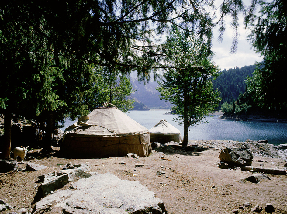
Above: simple lakeside huts in the Tien Shan Mountain range, which straddles the border between China and Kyrgyzstan, present an idyll of peace
(©Getty Images)


Below: trade is booming once again on the Silk Road, where an ancient culture is being connected with the modern world for the benefit of both
(©Getty Images)


A River Runs Through It

Early evening on the Nile in Cairo, and the sail of our felucca, the traditional Egyptian sailing boat, was swollen with pink light. Mohamed – guide, boatman, sage – was standing in the stern, balanced against a stay, guiding the tiller with his bare foot. Caught up in the arms of the river, we were talking pyramids.


“You are mistaken,” he said. “There are no secrets on the Nile.”


From vantages all over Cairo, from the windows of the new St. Regis Cairo to the ramparts of the Citadel, the great pyramids of Giza are visible beyond the rooftops, icons of the city standing on the edge of the western desert. Their scale is staggering; Napoleon calculated that the stone from the three pyramids could build a wall 9ft high around the whole of France. Their antiquity is scarcely creditable; they were already 2,000 years old when ancient Rome was still a collection of thatched hovels. But as much as anything, it is their silence that intrigues.


The pyramids tell us almost nothing about their occupants, about the lives they lived, about the world they came from. Only diligent archaeological detective work has discovered the names of the pharaohs buried within them. There are no inscriptions, no reliefs, no wall paintings. By the time the ancient Greeks turned up to swoon at the feet of the pyramids, even the contents were missing; the tombs had been looted centuries before. As a window on ancient Egypt, they are closed, shuttered and secretive.


Mohamed pushed the tiller starboard and we tacked towards the eastern bank, the direction of medieval Cairo. The old city, now a World Heritage Site, is the antithesis of the pyramids. In the warren of narrow lanes and alleys, vociferous life swirled around traditional Cairene houses, past some of the greatest buildings of medieval Islam. There seemed to be so few secrets here among crowds surging towards the clamor of Khan el-Khalili bazaar in search of everything from a cradle to a camel saddle, from perfume to chamber pots, from junk to jewels.


“But there are no secrets in ancient Egypt either,” Mohamed insisted. ‘Everything you want to know about the pyramids, about the men once buried in their chambers, about the world of ancient Egypt – everything, you will find along the banks of this river. The Nile is an open book.” Laughing, he scooped a handful of river water and splashed me. “Follow it,” he said. “It will answer all your questions.”


So follow it I did, though the idea of traveling the length of the Nile had occurred to me long before I had met Mohamed. A giant among rivers, the world’s longest and mightiest (though some claim this title for the Amazon), it runs almost 4,000 miles from its headwaters in the Mountains of the Moon in Central Africa to its twin mouths on Egypt’s Mediterranean coast. To anyone who loves travel, and the challenge of a grand journey, an expedition up the Nile is irresistible.


Beyond Egypt, it curves through Sudan and Uganda. But that perhaps is another river, and another story. In Egypt itself, a country that Herodotus described as the gift of the Nile, the monuments along the banks, and indeed the river itself, tell the story of the lost world of ancient Egypt in detail so graphic that we come to feel a part of it.


I followed the Nile from its mouth at Rashid on the Mediterranean to its source at Lake Victoria in Central Africa. For nine months I traveled in antiquated buses, in freight trains, in the backs of lorries, and wherever I could, on the river itself. I drifted to the tombs of Beni Hasan in a leaky boat piloted by an ancient fellow with the creased and leathery features of a pharaonic mummy. I traveled from Asyut to Luxor in a barge carrying cement, sleeping on a mat on the decks with the three-man crew. I sailed upriver in a felucca from Luxor to Aswan, stopping at the great temples of Edfu and Esna and Kom Ombo, picturesque on its bluff above the river.


I fell in love with the Nile, and the timeless life along its banks. In the early mornings, the surface of the river was glassy as egrets flew upstream, their yellow legs skimming their own reflections. Small boys shepherded dusty buffalo down to the water’s edge. Men appeared among the reeds, climbing into fishing skiffs. Caryatid women followed paths through the fields with water pots on their heads, moving like belly dancers – their bodies undulating, their heads perfectly still.


As the morning sun polished the river, voices drifted from the banks, elongating across the surface of the water. Blue-domed shrines rose from fields of sugar cane. An old man passed on a donkey. In the palm groves, between the aisles of tall trunks, flocks of sheep wandered through latticed shade, trailed by robed shepherds. On the Nile, past and present intersect; the fascination of these river banks, and of the fellahin or farmers who mine its waters, is how little has changed since the days of pharaohs.


Without the Nile, Egypt would not exist. The country is a desert, the eastern reaches of the Sahara, and its inhabited territory merely a long thin oasis, a line of irrigated cultivation, framed by dry wastelands. The border between the two is so distinct that you can straddle it, one foot in lush grasses, the other in sand. I wondered if ancient Egyptian anxieties about death might owe something to this tenuous geography, to the proximity of the enveloping desert, traditionally the land of the dead.


At Abydos in middle Egypt, I went ashore to see the great Temple of Seti. This was the journey every ancient Egyptian longed to make, just as Muslims today all wish to make the pilgrimage to Mecca. If they didn’t manage to come to Abydos in life, they believed their soul would travel here in death. Up and down the Nile on the painted walls of tombs, on the carved reliefs of temples, under the lids of sarcophagi, is this theme of river journeys, of boats, their sails hoisted to the north wind, all traveling to Abydos, the center of the Osirian cult of resurrection. The painted river scenes are eerily familiar to the modern traveler.


 Above: a felucca in Aswan, on the banks of the Nile

(©Tuul & Bruno Morandi/4Corners)


Largely intact, the temple is like the set for an Indiana Jones film, the remnant of a lost civilization. The disembodied voices of other visitors echoed between the stone walls. Figures flickered like ghosts in the shafts of light between the massive columns. The gloom deepened as I passed from one hall to another towards the inner sanctuaries where the gods lived.


Here, on the wall reliefs, some of the most beautiful in Egypt, all the secrets of the sacred rituals are displayed, rituals that would have been known only to the high priests and the pharaohs. We see the royal figure washing and dressing the statue that represents the God’s soul. We see the rituals of purification and the presentation of offerings. Finally, we see the pharaoh withdrawing, scattering sand on the floor, and sweeping away his own footsteps as he backs out of the sanctuary. These are works of art, masterpieces of the ancient world, and they appear on these walls like faded and cracked film footage from a world that flourished four millennia ago.


At Luxor in Upper Egypt, any lingering notions about the silence of ancient Egypt were soon overturned. Known as Thebes in ancient times, Luxor is a treasure trove of antiquities, and they come with a language, a history, a pantheon of identifiable gods, a list of kings, not to mention the endless tales of warring dynasties, of hopes and despairs, of political intrigues, and family conflicts, culled from inscriptions. On Luxor’s east bank stands Karnak, the colossus of ancient Egyptian temples, that has dazzled visitors for centuries. On the west bank, the funerary side of the river, I explored the Colossi of Memnon, the Ramesseum, which inspired Shelley’s Ozymandias, the Temple of Hatshepsut, a magnificent elegy for Egypt’s first female pharaoh, and Medinet Habu with its ithyphallic gods.


But it is in the Valley of the Kings that you come face to face with the fears and hopes of the ancient Egyptians. Sixty-three tombs and burial chambers are tunneled into the soft earth of this remote valley, their corridors lined with paintings that depict the rituals of death, and the images of paradise.


In the tomb of the Pharaoh Merneptah I made my way down the long tunnel towards the burial chamber. Along the walls were reliefs of elegant gods and their attendants with images of the dead pharaoh preparing for his journey to the next world. The carvings seemed as clean and precise as the day they were made. Their colors, after more than 3,000 years, glowed in the dim light.


I paused to examine the lithe figure of the Western Goddess. She was wearing a rather fetching topless frock. In the sloping tombshaft I passed the Hour Goddess, the different forms of Ra, the jackal Anubis, alert and watchful, past the sun disks and the scarab beetles, past the exquisite registers of hieroglyphics that unlocked the secrets of eternity.


At the bottom I emerged in the tomb chamber. All that remained was the granite lid of one of the four sarcophagi that had enclosed the mummy. Across the top was an effigy of the pharaoh, his arms folded across his chest. He was ageless. Beneath the lid was the beautiful Nut, goddess of the sky, stretched above the wrapped mummy like a lover. In one of these Valley tombs, some 19th-century graffiti captures the Egyptian anxieties as simply and eloquently as a dozen ancient reliefs. Scrawled on the hull of a royal barque is a single line: “You must not forget me.”


For ancient Egyptians, the next world was not a cloud-strewn heaven of angels and harps. Their paradise was simply the Nile. Their images of the next world were images of their beloved river. In the tombs we find feluccas with sails set, fishermen casting nets, boatman waiting for fares. If they were to live forever, what could be more divine than the banks of the Nile?


Over two millennia later, the third Aga Khan agreed. One of the world’s wealthiest men, he spent his winters in Aswan, and asked to be buried here on the banks of the Nile when he died in 1957. Every evening his mausoleum, standing on the west bank, darkens to a silhouette against a colored sky.


Now emphatically the end of Egypt, Aswan was for millennia the limit of the known world. Even in the early years of the 20th century, European visitors, enjoying cocktails on the terraces of the Old Cataract Hotel, could still thrill to the idea that beyond lay a barbarian darkness, little known and largely unexplored. Yet Aswan has none of the melancholy transience of a frontier town. It is a delightful and sophisticated place. If Luxor is a town of archaeological sights, an intense immersion in ancient Egypt, Aswan is a place for aimless meandering, where people come and go on boats.


One day I took a boat across to Elephantine Island, and strolled through villages where women sat on their doorsteps sifting rice and gossip. Another day I went upriver to the ruins of Philae, a temple that seemed to have sprung from the Nile itself. Through the empty windows of the Hall of Nectanebo were views of boats and water birds. Yet another day I explored the sprawling ruins of San Simeon Monastery, on a bluff, half a mile into the desert. Founded in the seventh century, it was originally dedicated to Saint Hadra, a cheery fellow who encountered a funeral procession on the day of his wedding. Seized suddenly with the tragedy of life, he went straight to a hermit’s cave without ever consummating his marriage.


In the evenings the feluccas spread swallow wings to the north winds that have carried boats up the Nile, against the currents, since before they built the Great Pyramid. Nowhere in Egypt is the river in such picturesque form, threading through islands between banks of desert sands and smooth granite. It looks, as the ancient Egyptians believed it to be, a kind of paradise.


Your address: The St. Regis Cairo


Above: fishermen on the banks of the Nile, between Luxor and Aswan
(©Günther Grafenhain/4Corners)

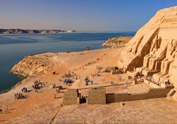
Below: the 3,000-year-old Great Temple of Abu Simbel, on the west bank 
(©Tuul & Bruno Morandi/4Corners)


Back to the Very Beginning

Two years ago, a friend I hadn’t seen in years phoned me from Washington, D.C. He was in the city on business and knew I lived in the Blue Ridge Mountains of Virginia, but he said he didn’t have time to visit “the South”. I told him something that surprised him. “You’re in the South, Jonny. Look out of your hotel window. That’s Virginia on the other side of the Potomac River. I live 50 miles west of there. Tell me when you’re free, and I’ll take you on a drive. It’s another country out here – great characters.”


I understood my friend’s surprise that cool, cosmopolitan D.C. was a Southern city, largely because I had to amend my own hoary clichés about the South when I moved here from New York five years ago to a historic 1733 Quaker village named Waterford, in the Piedmont region of rural northern Virginia. We could see the Blue Ridge, part of the Appalachian Trail, from our front porch.


We’d moved because my wife, a dyed-in-the-wool Yankee, wanted our kids to feel the grass beneath their feet, but still have proximity to D.C. I wanted all the Southern stereotypes: mint juleps, crumbling antebellum mansions, redneck moonshiners tending stills on starlit nights. What we got was something so utterly different it still surprises me today.


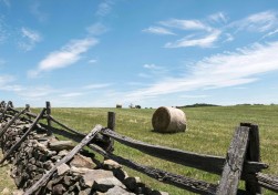
The land around us turned out to be far more Hamptons than hillbilly. Luminous green meadows dotted with sheep and horses stretched to the horizon; historic country homes with wrought-iron gates and oak-shaded driveways stood sentinel on hilltops, like mansions out of Edith Wharton novels. On any given weekend, we would drive winding, stone-fenced country lanes to our local tavern and run into scarlet-jacketed fox hunters riding to hounds. Loudoun, it turned out, was the richest county in America.


But the wider region was rich, too – in history. The land between the Blue Ridge and Route 15, a narrow north-south blacktop that runs 180 miles from Pennsylvania, past Waterford, on down to Charlottesville, Virginia, is one of the most historic corners of the U.S. It’s The Place Where America Happened. No fewer than nine presidents have lived on it or nearby; some of the greatest battles of the Civil War, including Bull Run (first and second) and Antietam, took place here, and world historic documents, from the Declaration of Independence to the Constitution, were either drafted or inspired by events on its route.


My friend had two days to spare, and I took him on the drive I take all visiting friends: a 350-mile loop from the Capitol, west on Route 50, through the chic horse country towns of Middleburg and Upperville (where Jackie Kennedy rode to hounds), and down Skyline Drive on the crest of the Blue Ridge into rural Rappahannock County. We would stop at Montpelier, family home of James Madison, father of the Constitution, then loop back up Route 15, Highway of Presidents, arguably the most eventful road in U.S. history.


I picked him up at the St. Regis, where he was staying, and we did a brief Capitol tour, cruising past the Lincoln Memorial on The Mall, and the Jefferson Monument along the Potomac. No fewer than eight U.S. presidents were born in Virginia, the Old Dominion, including four of the first five. George Washington’s grand estate, Mount Vernon, stands on a high bluff overlooking the Potomac near Alexandria to the south of us; it’s not on our route but it’s an essential stop for any D.C. visitor.


For the first 40 minutes, Route 50 is bumper-to-bumper through the suburban sprawl, but nearing Aldie, a strange thing happens. As if you’ve crossed a border, the development clears, and you’re suddenly in glorious countryside: luminous green fields; forests of maple, oak and birch; the Blue Ridge Mountains shimmering in the distance.


Route 50 meanders 3,000 miles from Maryland, through America’s heartland to California, but the 30 miles where it passes through Aldie, Middleburg, Upperville and Paris in the Piedmont are arguably the most gorgeous 30 miles in Virginia. The towns date back to the 1700s, when the road became a busy route for traders from colonial Georgetown and Alexandria accessing the farms of the Shenandoah Valley across the Blue Ridge. Stables, inns, taverns and mills opened to cater to passing carriages and horsemen, and as the settlements grew, grand estates sprang up on their outskirts. Today, Middleburg is a sort of Hamptons for the D.C. set, but with horses instead of beaches.


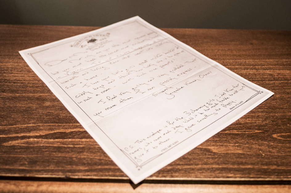
I park outside Country Classics, a raffish boutique selling tweed coats and cravats, and watch as blondes in jodhpurs and leather riding boots step out of mud-splattered Range Rovers. Middleburg is the heart of the Mid-Atlantic show-jumping, steeplechase and fox-hunting scene. Even the coffee shop is called the Giddy Up. We pop into the Red Fox Inn for coffee, the oldest building in town, a low-slung fieldstone “ordinary” from 1729 that reminds me of the Dickensian taverns of London. Above the front desk are gracious thank-you letters signed by Jacqueline Kennedy Onassis, from visits the former First Lady made here in the early 1980s.


It was Jackie Kennedy who put Middleburg firmly on the map, 20 years prior to penning those letters. When J.F.K. was president, she wanted a weekend retreat from the White House for her and the children. The Kennedys rented Glen Ora, a grand estate south of town, one of those sprawling mansions with oak-shaded driveways. Jackie joined the Orange County Hunt, her kids attended the local pony club, and the paparazzi followed. Middleburg was never the same again.


We pop across the street to The Home Farm Store, a former bank converted into a gourmet food store by Cisco Systems co-founder turned organic farmer, Sandy Lerner. Everything here is from Lerner’s farm, Ayrshire. After a six-dollar Scotch egg, we motor west. It’s early afternoon and the Blue Ridge shimmers above fields of boxwoods and beech. Then, like a mirage, a red British phone box appears as we enter Upperville. Welcome to the Hunter’s Head, my favorite country pub.


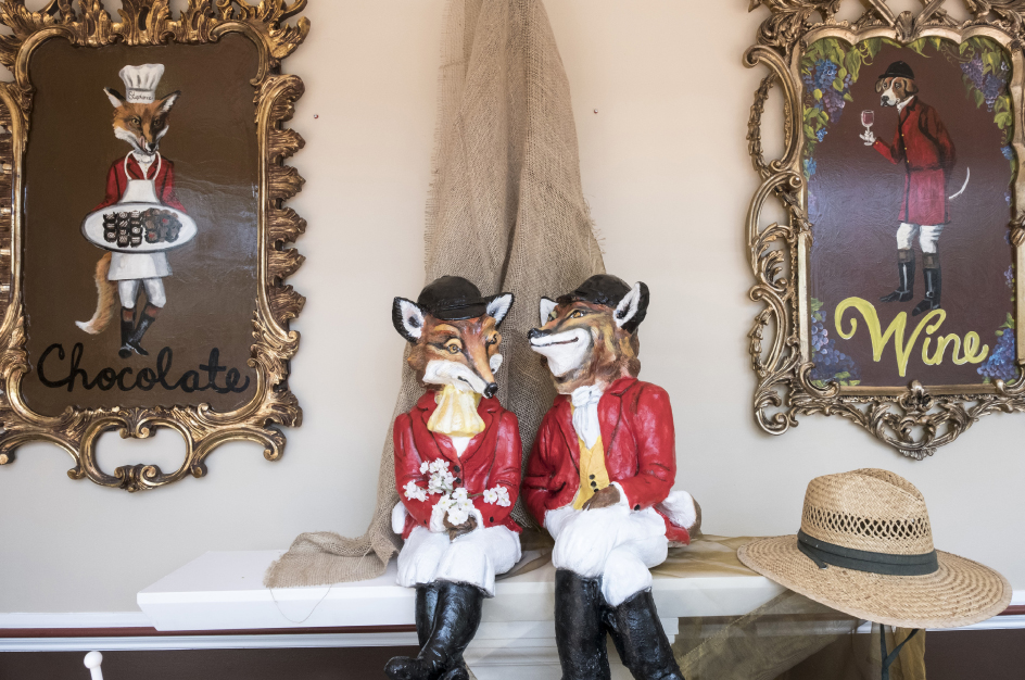
The tavern is a warren of cozy, low-ceilinged rooms, their walls covered with cartoons of foxes in riding hats. Built as a farmhouse in 1750, it looks like it’s been serving ale to ruddy-faced regulars since George Washington’s time. We tuck into bangers and mash with fresh bread, then walk off lunch in the village. It’s tiny, with the handsome sandstone Trinity Church, a few stone houses hugging the road, and a gun shop selling vintage muskets and Remingtons. As John Updike noted in a 1961 poem for The New Yorker, Upperville is even fancier than Middleburg:


In Upperville, the upper crust

Say “Bottom’s Up!” from dawn to dusk

And “Ups-a-daisy, dear!” at will

I want to live in Upperville.


“Mr. Rogers, cocktails in the parlor at 6.45pm. Don’t be late!” It’s time to meet some local characters, including Nat Morison, 76, seventh-generation Virginia Brahmin, owner of Welbourne, a 1770s country estate on a rutted dirt road, 15 minutes’ drive away (near the famous Foxcroft School for girls).


Welbourne, a custard-yellow colonnaded mansion on Nat’s 500-acre family horse farm, is a Piedmont mansion that doubles as a guesthouse. It was turned into an “invitation-only” inn back in 1930 by Nat’s grandmother. Thomas Wolfe and F. Scott Fitzgerald were invitees, and both wrote stories about it. I stay in Wolfe’s room (creaking four-poster) just past the library, where an imposing portrait of Nat’s bearded great-great grandfather, Confederate Colonel Richard H. Dulany, stares at me from the wall. Dulany rode with the great Gray Ghost, guerilla fighter John S. Mosby, in the war, and road signs throughout the Piedmont still venerate “Mosby’s Confederacy”, as the region became known.


American Heartland

Above: Wyant’s store, 12 miles west of Charlottesville, Virginia, lies in the Blue Ridge Mountains, near the spectacular 105-mile Skyline Drive. Below: the Hunter's Head, Upperville


You visit Welbourne for warmth and character, not frills. Sherry, Nat’s garrulous Connecticut-born wife, gives us “the tour”: three floors of dust-covered armoires, antique travel chests, shelves cluttered with faded Country Life magazines and leather tomes on war and horses. Picture Downton Abbey, if Carson, Mrs. Hughes and the rest of the staff had gone to the village fair 30 years ago and never returned. The music room (Nat collects – and plays nothing but – pre-1930s New Orleans jazz 78s) has a still-working Aeolian Vocalion gramophone and an out-of-tune 1907 Steinway. “It’s the eternal question,” Sherry sighs. “Fix the pipes or the piano?”
 

To me, this sounds like an unmistakably English sensibility, but when I mention this over cocktails (Virginia Gentleman bourbon on the rocks), Nat bellows at me like I’m crazy. “England? How would I know? I’ve never been out of America – except to New Orleans.”
 
In the morning, we motor south, leaving Route 50 for Fauquier County on a narrow, stone-fenced lane towards The Plains. A promising sun is burning off yesterday’s cold, and the land changes subtly here, becoming flatter and drier, yellow grass in open fields making it resemble Montana. The Plains are aptly named. The actor Robert Duvall has a horse farm here and is a regular at the local Virginia Gold Cup steeplechase in May, the Piedmont social event of the year. My Waterford neighbor,Tom, a political consultant, tells me he does more business in one afternoon at the Gold Cup than he does in a month at the Capitol.
 

It’s time to hit the Blue Ridge, and from The Plains we drive due west, detouring through the orchards, hollows and deer-specked valleys of Naked Mountain, part of Sky Meadows State Park, before accessing Skyline Drive at the resolutely blue-collar Front Royal. Built in the 1930s as a public works project, Skyline Drive is a spectacular 105-mile traverse running north-south through Shenandoah National Park on the crest of the Blue Ridge. There are 75 cliff-edge viewing points on its course and low hanging oaks and willows form a natural tunnel part of the way. To me, Skyline Drive is more than a road; it’s a barrier and symbol. Below, to the west, the Shenandoah Valley, its great river a muddy snake on the plains, is the start of the American heartland, while down to the east, the Piedmont, as green and delicate as a country garden, clings to the ways and manners of the Old World.
 
Skyline Drive ends in the town of Charlottesville, home of another Virginia President, Thomas Jefferson, author of the original American document, the Declaration of Independence. His majestic plantation, Monticello, which he built in French Revival-style, stands atop a hill overlooking a sea of green forest. Somehow, 230 years of development in the nation he helped found have not encroached on his view.
 

We don’t have time for Charlottesville, though, and instead keep it local, exiting Skyline Drive on Route 211 at Thornton Gap, descending into Sperryville, a river-splashed Piedmont farming town somnolent in the shadows of the Blue Ridge. Seventy years ago this was a bustling outpost, last stop before the mountain for traffic heading south-west to New Orleans and beyond. Then, in the 1950s, the highway was built at Front Royal, and Sperryville fell into slumber. In retrospect, it saved the town. Today, it’s a bucolic retreat with a creative subculture of organic farmers, artists, chefs and artisans. I make my way to the River Arts District, former apple-packing sheds on the Thornton River, converted into studios, galleries, and a tapas restaurant.
 

The highlight is the Copper Fox Distillery, where fortysomething Rick Wasmund makes award-winning ryes and whiskeys using a unique technique: he accelerates the aging of his spirits by adding a sachet of small “chips” of charred wood (oak, apple, and cherry) to the aging barrel, increasing the wood surface area. The result is astonishing: rich, smoky spirits with a delicate, fruity finish. I ask him how he came by the method, and he tells me he was caretaker at an old mansion in Middleburg that had eight fireplaces. “I had to light them every night, and I got to experimenting with smoke and wood, which got me to thinking about whiskey.” A brief stint at a distillery in Scotland and, lo, an idea was born.
 

We consider the power of ideas an hour later. We have taken the scenic 231 South for an hour and found our way to another presidential home: Montpelier, home of James Madison, the fourth president. A handsome two-floor neoclassical mansion on a 2,500-acre estate, Montpelier was built by Madison’s father in 1764, and remained in the family until 1840. In 1901, it was bought by the duPont industrialists, who added a garish mural to its façade and a steeplechase track – as you do. But in 2008, after a painstaking $24-million restoration, it was returned to the way it originally looked back in Madison’s day.
 

From the second-floor library, I look out on the same incomparable Blue Ridge view Madison had surveyed in 1786 as he considered all those weighty questions. A towering intellectual, he read more than 400 books in seven languages while he was drafting the documents that would form the basis for the U.S. Constitution, including, as our guide explained, texts in original Latin, Hebrew and Greek. “They don’t make ’em like that anymore,” someone next to me mumbles.
 

It’s late afternoon by the time we double back on to Route 15, now part of The Journey Through Hallowed Ground national heritage area that links Jefferson’s Monticello to the Gettysburg battlefield in Pennsylvania, 180 miles to the north. Several other battles took place at points along its route including Manassas, site of the First Battle of Bull Run, the brutal first big clash of the Civil War. Waterford, my own town, lies just off it. I take Jonny to see it before driving him back to the St. Regis in D.C. We sit on the porch sipping a bourbon as the sun sets over Blue Ridge. For some reason I think of New York City and the big move south. I have no regrets. I’m in Virginia, where America began.

Your address: The St. Regis Washington, D.C.

History in the making

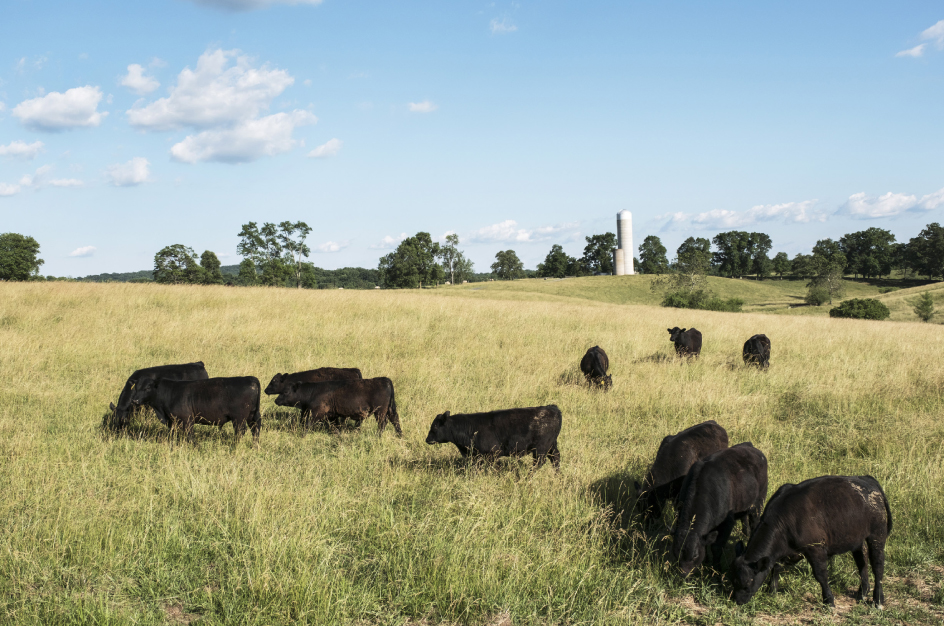
Above: a letter from Jacqueline Kennedy Onassis to the Red Fox Inn in Middelburg. Below: rustic beauty and old-world charm characterize this historical region just outside Washington, D.C.


City of Gods

It’s those beautiful artists’ impressions of the Aztec capital of Tenochtitlan that make people say so many unjust things about Mexico City. The emerald-hued lakes, the slender causeways, the story of Montezuma, enthroned in his feathery splendor, warmly greeting Hernán Cortés – only to be betrayed by the duplicitous conquistador, cut down in his prime, and the Aztec empire crushed.


It’s true that when you fly into Benito Juárez International airport, you can’t help lamenting that such a wonder has been buried beneath millions of tons of concrete, and a sprawl of houses, apartment blocks, shanty towns and suburbs that shatters the human scale while housing 20 million human beings, or more – no one really knows. Nevertheless, Mexico City, or DF (pronounced day-efay, standing for Distrito Federal) as everyone calls it, is not the impenetrable, car-dependent maze of modern myth. Indeed, a pleasant introduction to the center, and one that subverts several stereotypes about the Mexican capital, is to walk it, slowly, calmly, flaneurishly, from Aztec heart to contemporary barrio.


I begin where you have to begin: standing at the center of the Zócalo, the vast main square; officially the Plaza de la Constitución, though no one ever calls it that. This is where Mexicans protest and march, celebrate and stroll, kiss and tell. The Spanish included grand plazas in all the major cities they built over pre-Columbian settlements, and one has to suspect that the Zócalo is one of the biggest of these because it had to symbolically bury the majesty of what stood here before.


Parades and expos occasionally invade the plaza, but today there are only strolling locals, a statue of Cuauhtémoc, the last native ruler of the city, and a massive Mexican flag, unfurling in the warm morning breeze.


A magnificent vestige of the pre-Hispanic city lies at the plaza’s northeastern corner. The Aztec Templo Mayor was Tenochtitlan’s sacred hub, continually expanded over two centuries by the city’s rulers. The archaeological site is no mere pile of stones, but rises, strangely, magnificently, with serpents greeting you as you turn a corner, and daubs of the red, blue and yellow paint that once glowed under the highland sky. The temple was dedicated to Huitzilopochtli, sun god and bringer of war, and Tlaloc, the rain god and source of fertility. Arid death and liquid life.


Right next door, the vast Metropolitan Cathedral is the biggest cathedral in the Americas. It’s a squat, hulking edifice, designed to crush any memory of what might have been worshipped here before the arrival of Cortés and his Christian soldiers. A medley of baroque, neoclassical and Spanish churrigueresque (elaborate stucco ornamentation) elements, it too has been built and rebuilt several times over the centuries.


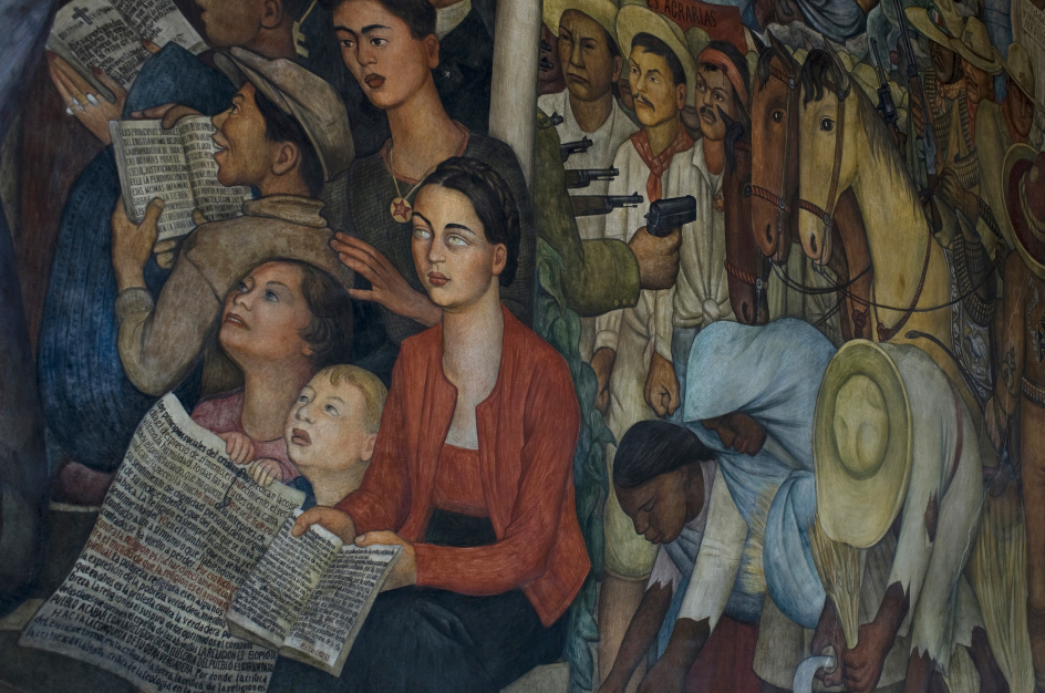
Before exiting the Zócalo I duck into the Palacio Nacional to see Diego Rivera’s murals, which decorate the stairwell and the middle story of the central courtyard. The panoramic piece, titled México a través de los Siglos (Mexico Through the Centuries), conflates the dramatic history of this great nation into what looks at first glance like an insane group photograph – with Quetzalcoatl (the plumed serpent) rubbing shoulders with Zapata’s revolutionaries, who are in turn looking down on the dastardly inquisitors, Hidalgo the liberation hero, five-times president Benito Juárez, and many other assorted great and good, plus Rivera’s wife, Frida Kahlo, and Karl Marx, helpfully giving directions to the massed proles.


I’m dizzy with names and blinded by colors by the time I get back outside. I grab breakfast at the nearby Café de Tacuba. This handsome institution, all tiled walls and white-aproned waitresses, has been serving good coffee and sublime tamales – chicken-filled corn wraps served with spicy sauce – since 1912. It also lent its name to a well-known Mexican pop group.


I continue west along Calle de Tacuba, which lies along the axis of one of the lake-city’s original causeways. It’s an elegant part of the city, with a distinctly European feel, though I occasionally arrive at hectic, aromatic corners where streetfood vendors are whipping up filled tortillas and crispy tacos for the time-poor traders and political aides who work in these parts.


Billionaire investor and philanthropist Carlos Slim has been throwing money at the city center, and many facades look new or very well polished. Edifices that were little more than warehouses or squats have been taken over as office space, work-live accommodation and nightspots. Prone to seismic activity, Mexico City is a mid-rise city, though I occasionally catch glimpses of the lofty, 597ft, 44-story Torre Latinoamericana, a glass and steel quake-proof landmark that was once the tallest building in Latin America.


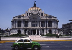
My next stop, in the shadow of the Torre, is the Palacio de Bellas Artes. Built during the 1876-1911 Porfiriato – the modernizing, if sometimes brutal, regime of Porfirio Díaz – and facing the Alameda Central, it’s one of Mexico City’s most beautiful palaces. Begun in 1904 and overseen by Italian architect Adamo Boari, a fan of neoclassical and art nouveau lines, its construction was interrupted by subsidence issues and then the Mexican Revolution. It was completed by Mexican architect Federico Mariscal in the 1930s, with the interior leaning towards the then-fashionable art deco style.


The three expansive floors of Mexican and international art merit a day or more, but I limit myself to viewing pieces by Rufino Tamayo, David Alfaro Siqueiros and Diego Rivera, including the celebrated El hombre en el cruce de caminos (Man at the Crossroads), originally commissioned for New York’s Rockefeller Center. The Rockefellers had the original destroyed because of its anti-capitalist themes, but Rivera recreated the work here in 1934.


The Alameda Central is one of relatively few green spaces in the Cuauhtémoc quarter. Created by Viceroy Luis de Velasco at the end of the 16th century, and enlivened by paved footpaths, decorative fountains and statues, it occupies what was once an Aztec marketplace. The name comes from álamo, Spanish for poplar tree.


These elegant gardens provide a natural border between old, romantic DF and the Paseo de la Reforma, the throbbing heart of modern Mexico’s economy. Skyscrapers loom over every block of the Reforma, including impressive landmarks such as the Torre Mayor, owned by George Soros, Torre HSBC, the Angel of Independence monument and César Pelli’s sleek Torre Libertad, home of The St. Regis Mexico City.


I make a slight detour to the Plaza de la República to admire the Monument to the Revolution, a towering neoclassical triumphal arch that doubles as a mausoleum for several heroes of the Mexican Revolution of 1910, including Francisco “Pancho” Villa.


Diego Rivera’s panoramic mural, ‘Mexico Through the Centuries’, conflates the dramatic history of this great nation into what looks at first glance like an insane group photograph


Street life

A hop away at Calle Antonio Caso No. 58, is the Cantina La Castellana. Established in 1892, it’s one of a dozen or so traditional cantinas left in the ever-evolving, fad-hungry capital. It has 13 big TV screens, six of them showing a soporific, scoreless Mexican football match, six an overacted soap opera, and one a grisly news bulletin. There’s a cheap buffet, into which the clientele of working class men is diving with gusto, filling soup bowls and piling up plates of potato, meat and beans. I opt for the daily special, which today is the very Mexican chamorro enchilado al horno – oven-baked, chilli-peppered pig’s leg – superb with a well-iced bottle of beer.


Buzzing, cozy, laid-back, this cantina, like all the best ones, is timeless. Some of the men are playing dominoes. Several are just having beers and botanas – salty snacks. Mariachis sometimes drop by, usually in the afternoon, not because they think tourists will reward them but because they are appreciated here. La Castellana also has some cultural cred: past visitors included author Renato Leduc, who hung out with Antonin Artaud in Montparnasse, and songwriter Álvaro Carrillo, who composed more than 300 songs, most of them romantic boleros. Poet Pablo Neruda, Communist activist and essayist José Revueltas and poet Efraín Huerta were also habitués.


After lunch – the match still at zero-zero, the dominoes still clacking – I’m back on to Reforma, which is busy with lunchtime traffic. The thoroughfare was commissioned by Habsburg Emperor Maximilian I to seal his authority on the city after overthrowing Benito Juárez in 1864. Designer Ferdinand von Rosenzweig’s intention was to grace the imperial capital with a grand boulevard equal in grandeur to the Ringstrasse in Vienna. It would also serve as direct route to – and an imposing sightline for – the Castillo de Chapultepec, the imperial residence.


Reforma these days feels very modern, with police zipping along the wide pavements on Segways, and the mainly modern and functionalist architecture and bank and brokerage HQs attesting to the power of commerce rather than conquering viceroys. After the narrow grid of the old city, it’s good to see some sky, too. I don’t generally do shopping, but I decide to stop briefly at Fonart at Paseo de la Reforma No. 116. Buying local handicrafts is a minefield for travelers, but these government-run, fixed-price outlets are a joy: superlative textiles and art are on display and browsing is more like a museum visit rather than mere retail.


The Altar a la Patria, six white marble columns honoring six teenage cadets who died in the 1846-8 Mexican-American War, marks the entrance to the Bosque de Chapultepec – a name that means Chapultepec Wood but doesn’t quite capture the magnitude of this verdant megaspace. Spreading over some 1,695 acres, it’s one of the biggest city parks in the world. Made especially delightful by its hilly contours, it invites you to breathe deeply, take in a view over DF and enjoy a few minutes of silence – well, subdued traffic hum, anyway. Native carpenter birds and hummingbirds sing and tweet, and the park is a refuge for migratory birds from Canada and the U.S., including the red-tailed hawk and Harris’s hawk. Dozens of tree species provide shade, including the Montezuma bald cypress, Mexico’s national tree.


Overlooking all this is the Castillo de Chapultepec, accessed via a winding, gently inclined road. A sacred spot for the Aztecs, the mansion we see now is a reminder of Mexico’s bygone aristocracy. It was begun in 1775 but not completed until after independence, when it served as the national military academy. When Emperor Maximilian and Empress Carlota arrived in 1864, they gave it a regal refurbishment and it was the presidential pad until 1939 when it was converted into the Museo Nacional de Historia.


The displays chronicle the periods from the rise of colonial Nueva España to the Mexican Revolution. Even more impressive than the sumptuously furnished salons, swords and banners are the dramatic interpretations of Mexican history by muralists Juan O’Gorman and David Siqueiros. Huge, overpowering and full of the everyday chaos of humanity, Mexican mural art enfolds and moves the viewer in a way sedate, framed gallery art can’t. I leave the museum feeling uplifted as well as informed.


It’s only a 20-minute walk to my final cultural pit stop, one of the world’s greatest museums. This is only my second visit to the Museo Nacional de Antropología but I know what not to do: try to take in 23 rooms and more than 4,000 years of pre-Columbian art and culture in a single sweep. Instead I focus on a couple of eras. The Olmecs – the first major civilization in Mexico, present from the 16th to the fifth centuries BCE – tend to get less attention than the Aztec and Maya but, as the colossal heads, clay dolls, vases and figures on show demonstrate, theirs was a bold and brilliant culture.


The museum’s building is an artwork in its own right. The umbrella-shaped edifice was designed by three visionary Mexican architects, and when it opened in 1964, the soft, tropical brutalism was considered audacious. The exhibition halls surround a courtyard and a large pond so that as you move between rooms you find yourself suddenly in a serene, airier space. It readies the spirit for the next bout of learning and awe.


My second specialism for the day is the Maya. While I’d seen many of the magnificent sites around Yucatán, it filled in gaps to see the altars and artworks shipped from the peninsula to be exhibited in the capital. Indeed, when it comes to everything in sprawling, multi-faceted Mexico – from food to art to music to commerce – in the end all roads lead to DF. The capital sucks in energy and creativity and concentrates it here.


The sun is slipping away and the gardens around the museum are cooling down, breathing out their evening perfumes. I walk slowly towards the north, exiting into Polanco – Mexico City’s most upscale neighborhood. As barrios go, compared with the shabby chic of Condesa and the hip, emerging buzz of Roma, Polanco is sedate and civilized. Which is a relief – because after a longish walk (only about six miles but lots of zigzagging and art-filled corridors along the way), I need some leafy luxury and lounging.


Polanco was originally a hacienda (rural estate) and then a suburb until the early 20th century, when mansions began to pop up surrounded by old-growth trees and high walls. First retail moved in and then, from the Seventies on, companies fed up with the gritty flavor of the Zona Rosa relocated here. Embassies, restaurants and boutiques followed, and sleek towers were erected to house their well-heeled employees. As a result, Polanco has also become one of the city’s best spots for high-end dining.


Before I partake, I need a drink. Jules Basement prides itself on being Mexico City’s first speakeasy. The term means very little nowadays but there’s still something exciting about passing through a big fridge door and some rubber drapes to find yourself in a shimmering space – all black, white and silver: cool in the shivery sense – with cocktail tables inspired by Mexican skull art. A bit industrial, very theatrical, and somehow very Mex-urban, it’s a good spot for a pre-dinner cocktail. I have a mescal-based Negroni that wipes out the day’s toils and then a cool artisanal beer.


My last stop is a place I first read about in the influential S. Pellegrino World’s 50 Best Restaurants listings. Polanco boasts three top-rated places within a few blocks. Quintonil and Biko are two, but I opt for Pujol, where El Bulli-inspired chef Enrique Olvera specializes in refined versions of native cuisine. He cooks with ant larvae and grasshoppers and, in a nod to local streetfood culture, prepares one dessert with a 20-day-old banana.


The tasting menu is a series of taste volleys, from fried pork to delicate sweetbreads to a succulent tamal (closing the circle I’d begun at breakfast) to a range of moles – Mexican sauces, some with chocolate and sweet spices – and a glass of Baja Cal white. The meal is deeply indigenous, and as exquisite on the palate as anything the Old World has to offer. A DF mini-banquet. A megalopolitan treat. A fitting finale to one of the world’s great city walks.

Your address: The St. Regis Mexico City

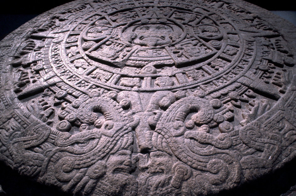
A relief sculpture of an Aztec calendar, in the Museo Nacional de Antropología,
showcase for 4,000 years of pre-Columbian art and culture

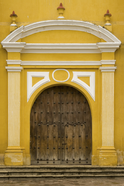
A church doorway

To Rome with Love

When Mary Shelley sat down to write her letters home in the early spring of 1819, she had already fallen in love. The author of Frankenstein and the wife of the famous poet had arrived in Rome a few days before, and the city had seduced her. Basking in the warm Roman sun, contemplating countless masterpieces across two and a half millennia of history, she was enthralled. “The delights of Rome have had such an effect on me that my past life appears a blank,” she wrote breathlessly, “and now I begin to live.”


Mary knew well the Piazza del Popolo, the square in which I am sitting at the Caffè Canova, enjoying a croissant and the best coffee in the world. A wide oval, the piazza is framed by curving balustraded roadways and centred on fountains spewing curtains of silver water. To the south, twin churches mark the entrance to the city. On the opposite corner, by the Dal Bolognese restaurant, where film stars dine on Saturday evenings and cardinals have Sunday lunch, two carabinieri pose in uniforms that are more Gilbert & Sullivan than constables on the beat. Two nuns glide by, twins in wimpled black, passing a young couple locked in an embrace on the rim of the central fountain. The shadow of the obelisk that Augustus brought back from Egypt after defeating two of the great lovers of antiquity – Antony and Cleopatra – stretches across the cobblestones to touch my feet.


Cavalcades of ghosts roam this piazza. Before trains and airplanes gave us more mundane backdrops, the square was the grand stage for Roman arrivals. For more than 17 centuries, all those who made the journey to Rome from elsewhere in Europe – kings and popes, armies and emissaries, merchants and pilgrims – entered the city through the great Porta del Popolo opposite. Martin Luther lodged here while formulating ideas that would lead to the great schism of the Protestant Reformation. Queen Christina of Sweden – libertine, libertarian and lesbian – rode through Porta del Popolo opposite, waving to welcoming crowds, believing she was escaping the constraints of a northern throne for the freedoms of southern indulgence. Bonnie Prince Charlie – pretender to the thrones of England, Scotland and Ireland, and born in this city – paused here to splash his face in the fountains after another drunken night.


But the journeys and the arrivals that fascinate me are those of the early tourists, the travelers on what came to be known as the Grand Tour, a phenomenon of the 18th and 19th centuries in which gentlemen and sometimes ladies of means toured the continent to add some polish and sophistication to their manners and education. With its wealth of artistic treasure, Italy was always the highlight of these European journeys, and Rome, the ‘Great Crown of the Grand Tour’, the ultimate destination.


Among them were famous writers and artists. John Keats, Percy Bysshe Shelley and Lord Byron all hurried across the cobbles of Piazza del Popolo. Stendhal, Algernon Charles Swinburne, William Wordsworth, Sir Walter Scott, Nathaniel Hawthorne, Charles Dickens – all went “reeling and moaning about the Roman streets”. Henry James echoed Mary Shelley’s passion for the city. “For the first time,” he wrote to his brother on the evening of his arrival, “I live.”


The journey to Italy and to Rome started with the Alps, “those uncouth, huge, monstrous excrescences of nature”, according to one 18th-century traveler. Some visitors, like Horace Walpole, whose King Charles spaniel was carried off and promptly eaten by a wolf, rode mules along the snowy precipices. Others, like James Boswell, were carried in palanquins by sure-footed porters. Boswell was said to have crossed the Alps “with mingled feelings of awe and adulterous anticipation”. Italian women were one of the attractions of any journey through Italy.


Boswell was probably anticipating Venice, whose courtesans were famous. The Frenchman Charles de Brosses described them as a cross between fairies and angels; heroically, he tried eight in order to get a decent sampling. But nuns were generally considered to be the most passionate lovers in Venice; there was a famous incident of a nun fighting a duel with an abbess over a mutual lover. Someone should have told Boswell. His adulterous intentions towards a promising Venetian woman “of some social standing” met with a sad rebuff.

 The Colosseum

Lovers on the Pincio Hill

From Venice our travelers crossed the Apennines to Florence. The journey could be difficult (in one wayside inn William Beckford was offered a dinner of mustard and crow’s gizzards) but everyone loved the city on the Arno. As always, there seemed to be too much to see: one 18th-century guidebook listed 160 public statues, 152 churches, 18 guildhalls, 17 palaces, six columns and two pyramids, without even mentioning the countless paintings. Tired of the sights, Sir Horace Mann was fortunate to catch the Carnival with its masked balls and its bacchanalian amusements. “I have danced,” he cried. “Good Gods! How have I danced!”


As the travelers turned south to Rome they followed the Via Cassia of the Roman legionnaires and the Via Francigena, the centuries-old pilgrim route to Rome. Both led directly to the Porta del Popolo, where, stretching their legs, they marveled at the theatrical entrance to the city. But the piazza was hardly journey’s end. Rome, which Lord Byron called “the city of the soul”, awaited them.


I finish the last of my croissant and coffee and set off to follow the travelers on their ramblings around the city they knew as Caput Mundi, the Capital of the World. A short walk round the corner into the Via del Corso, once the scene of riderless horse races, brings me to the rooms where Goethe lodged. The great German writer came to Rome in search of classical art. But in the humble rooms in Via del Corso, where he once lay writing verses on his lover’s naked back, he found love, passion and erotic emancipation. By his own account, Rome and his love affair with his Italian mistress changed his life. “Eros has arrows of various kinds,” he wrote. “Some seem just to scratch us… others, strong-feathered and freshly pointed and sharpened – right to the marrow they pierce.” His love nest is now a small museum, the Casa di Goethe, and its exhibitions trace the transformations of the man known as the German Shakespeare. Pick up a copy of his Roman Elegies; erotic poetry was never so exquisite.


From Goethe’s apartment I cross to Via del Babuino and the entrance to Via Margutta, one of the most charming streets in Rome. Long associated with visiting writers and artists, it was home to people like Sir Thomas Lawrence, the president of the Royal Academy of Arts, who lived here in the early 19th century. It is the street itself, as well as its associations, that is so seductive. Rising rents have forced most artists to look elsewhere for studios, but this pedestrian backwater, with its small galleries and antique shops, retains the atmosphere of an earlier Rome. The tiny Osteria Margutta at number 82 is my favorite place for romantic candlelit dinners. Bring along a copy of Goethe’s Elegies to read over the dolci.


Back in Via del Babuino I’m on the trail of Keats, the tragic young poet who arrived in Rome in 1820. At the end of the street I emerge in the Piazza di Spagna, where the Spanish Steps, strewn with flowers, rise to the double spires of the church of Trinità dei Monti. In the 18th and 19th centuries the area was known as the English Ghetto. As early as 1740, Horace Walpole was complaining that the English in Rome seemed numberless; the Italians had taken to calling them milordi.


Just to the left of the Spanish Steps is one of their favorite haunts, Babington’s Tea Rooms, still serving English afternoon teas between the beveled mirrors and the palms. Not far away, in fashionable Via Condotti, is another of their haunts, the Caffè Greco. After two and a half centuries, the fittings and the paintings still evoke the long-lost world of the Grand Tour.


Hard by the Spanish Steps is the Keats-Shelley House, now a museum to the two Romantic poets. Already suffering from tuberculosis, a lovelorn Keats came to Rome in the hope that a sunnier climate might provide a cure. With its book-lined rooms, the house is a wonderfully atmospheric place. I climb the stairs to the narrow chamber where Keats lay day and night gazing at the ceiling that his friend, the painter Joseph Severn, had decorated with flowers for him. He died here, on a dark winter day in February 1821, barely 25 years old, still dreaming of his beloved Fanny Brawne, left behind in London. It remains one of the most moving places in Rome.


Back outside I climb the Spanish Steps to the district of the visiting French. Architects routinely praise the way the steps are visible from all angles. But the builder, Francesco de Sanctis, did not have aesthetic considerations in mind. “I will make the steps visible from everywhere,” he sniffed, “because the reverend fathers [of the French church atop the hill] have alerted me to the gross indecencies committed on that shrubbery slope by couples who often hide there.”


The French always have an eye for the best real estate, and the area at the top of the steps enjoys some of the finest views in Rome. I follow the Viale Trinità dei Monti to a wonderful Renaissance creation, the Villa Medici, “acquired” by Napoleon for the French Academy. Visiting artists are still granted studio space here, but for the general traveler there are tours of the apartments and the gardens that feel like a secret retreat. A little farther along the Pincio Hill is the Casina Valadier, named after the man who designed the Piazza del Popolo. Its elegant terraces are the ideal place for lunch with a view over Roman rooftops where domes rise like hot-air balloons.


Away to the left, you can see the white “wedding cake” creation of the Monument to Victor Emmanuel II, commonly called the Vittoriano, and just behind it, the Forum of ancient Rome. In the days when Latin and Greek were still part of a normal school curriculum, most travelers on the Grand Tour had read Cicero and Virgil, Ovid and Horace, and were thrilled to be wandering the streets where they had lived and died. Many enlisted the services of guides to show them around ancient sights. The great German guide Johann Joachim Winckelmann, who became the leading 18th-century authority on classical art, was much sought after. He was a man of considerable tact. Showing John Wilkes around the Forum, Winckelmann kindly pretended not to notice when he and his mistress, overcome by lust, disappeared for some moments behind a ruin. All the more obliging, Wilkes commented later, because he had to pass the interval with his mistress’s mother, “who had as little conversation as beauty”.


But no visitor is more closely identified with ancient Rome than Edward Gibbon. I climb the long steps to Michelangelo’s glorious Piazza del Campidoglio, centred on the equestrian statue of Marcus Aurelius. Just beyond the piazza in the far left corner is a balcony overlooking the ruins of the Forum. Gibbon came here one fateful evening in the autumn of 1764 in reflective mood. The sound of the friars chanting litanies in the Church of Santa Maria d’Aracoeli wafted across the piazza. As he looked down on the Forum “where Romulus stood, or Tully spoke, or Caesar fell”, he conceived the idea of writing The Decline and Fall of the Roman Empire, one of the seminal works of European history.


Keats’ great friend Shelley also found inspiration in Rome’s sprawling ruins. Shelley adored Italy and spent several years here, where his curious domestic arrangements – in addition to his wife Mary he seemed to travel at different times with two mistresses – didn’t seem to raise any eyebrows. The spring of 1819 found him lodged with Mary, Claire the “nanny”, and his son William in the Palazzo Verospi in the Via del Corso, not far from where Goethe had lived some decades earlier.


The Shelleys spent their mornings exploring the ruins and the art collections and their afternoons riding through the gardens of the Quirinale and the Villa Borghese, the latter still Rome’s great green oasis. In the churches, Mary wrote, “we see the divinest of statues and… hear the music of angels”. Shelley loved to wander the city alone by moonlight, when the evening breezes brought sweet aromas from the country. His favorite destination was the vast Baths of Caracalla, the most spectacular of Rome’s ruins. It was here, beneath the arches, that he wrote Prometheus Unbound.


I hop on the No. 3 tram from Trastevere to the Protestant Cemetery, one of the stops on Shelley’s moonlight rambles, by a southern gate of the city, close to the Pyramid of Cestius. “It might make one in love with death,” he wrote, “to think that one should be buried in so sweet a place.” Pines and cypresses separate the rows of tombs. The colony of cats that has lived here for generations has its own charity box just inside the gate. You can find Keats’ grave in the far left corner, shaded by trees, inscribed with a single line: “Here lies one whose name was writ in water.”


In July 1822 Shelley drowned after his boat capsized in a storm off the coast at Livorno. Mary accompanied his ashes across the Piazza del Popolo and through the city to burial in the cemetery. His gravestone is inscribed with Ariel’s lines from The Tempest: “Nothing of him that doth fade/But doth suffer a sea change/Into something rich and strange.”


It reads like an epithet for the city itself, the Eternal City, still rich and strange, still unfaded after the many sea changes of two millennia. For generations of visitors, Rome has been a revelation. No city in the world has been the destination of so many journeys, or has transformed the lives of so many travelers.


Your address: The St. Regis Rome

 Catching up with the news outside the Pantheon

Gauguin’s Polynesia

In 1891, it took Paul Gauguin 63 days to sail from Marseilles to Tahiti. This year, it took me 22 hours to fly from Paris. The reception each of us received couldn’t have been more different. Whereas the arrival of the 43-year-old French painter, sporting shoulder-length hair and a cowboy hat, caused much mirth, I’m greeted at Faa’a International Airport with strumming ukuleles and a garland of heavenly scented flowers. It is warm and sunny, the hills are alive with tropical colors, the gorgeous blue ocean is fringed with joyful white-capped waves. Everything is instantly, and emphatically, de-stressing. As the artist put it in Noa Noa, the enigmatic illustrated journal he began on his first trip here: “Little by little, step by step, civilization is peeling away.”


Gauguin’s paintings inspired by his time in French Polynesia have become synonymous with our image of the South Seas. With their rich and glowing hues, strong outlines, confident-faced nudes, lush landscapes and underlying mystery, they are unfailingly exotic. They sing of heat, natural abundance, sensuality and spiritual succor, and the world loves them. In 2003, when the landmark Gauguin-Tahiti exhibition was held at the Grand Palais in Paris to mark the centenary of his death, more than half a million people queued to see famous works such as Ia Orana Maria (Hail Mary) and Where Do We Come From? What Are We? Where Are We Going?


Inevitably, there is commercialism. The gift shops of Papeete, the island capital, are awash with shopping bags, tablemats and even flowerpots exploiting the painter’s masterpieces. Today a 332-passenger ship, Paul Gauguin, cruises the Society Islands, as Tahiti’s central archipelago is known. This name was bequeathed by Captain Cook in 1769, who drily observed in his journal how “more than one half of the better sort of the inhabitants have entered into a resolution of enjoying free liberty in love, without being troubled or disturbed by its consequences”. It’s a reminder that Gauguin was but one of many visitors to confirm the multiple charms of French Polynesia. Two decades after Cook, the Bounty mutineers famously demonstrated the lengths sailors would go to in order to stay in its warm waters, just as writers such as Robert Louis Stevenson, Rupert Brooke and Somerset Maugham spread the word in later years.


Tahitian women in a banana grove,
looking as though they have stepped out
of a Gauguin painting


Sunsets in the South Seas are as magnificent
as anywhere on Earth. Above is majestic Mount Rotui
on Mo’orea, one of many peaks on the island
that made a great impression on Gauguin


As the critics like to tell us, though, Gauguin’s paintings were a fantasy. He yearned to escape bourgeois routine, to find the primitive and essential. Unfortunately for him, the London Missionary Society got here first. In the Musée de Tahiti et des Îles, I contemplate black-and-white photos of local families taken from the 1860s onward, in which all the women wear decidedly unrevealing full-length dresses known as “Mother Hubbards”. My driver-guide is entertainingly blunt on this. “First the English came, telling us to cover up,” he says. “Then the French came, telling us to undress. We prefer the latter.”


Tahiti is actually two islands linked by an isthmus, and as I drive around its figure-of-eight, admiring the mighty forest-cloaked mountains and black-sand beaches, it is not hard to find scenes straight out of Gauguin. A horse grazes in a field of luminous grass, mangoes ripen on a table, vahines (Polynesian women) with long dark hair and a bright flower behind the ear relax on the beach. “Everything in the landscape blinded me, dazzled me,” the painter wrote. Once here, it was natural to paint a red close to a blue. “There is a continuing supposition,” argues his biographer David Sweetman, “that Gauguin invented his own Tahiti, particularly in respect of his colors, but one can only hold to such a view if one has never visited.”


Most visitors use Tahiti only as a stepping stone to the other islands, but it is worth a tour. Highlights include the Plateau de Taravao viewpoint, the dramatic surfing spot of Teahupo’o, and Mataiea, where the painter retreated to live in a bamboo hut. It’s sad but understandable that there are few original works by Gauguin to be seen on the island and that the Gauguin Museum, which has them, is currently closed for lengthy renovations. If you want to behold the art that resulted from this great creative adventure you’ll need to visit major galleries in cities such as New York, Boston, Paris and St. Petersburg.


But the real subjects are everywhere. Looking across from Tahiti to the graph-like peaks of neighboring Mo’orea for the first time, I’m as stunned as Gauguin was. “The mountains stood out in strong black upon the blazing sky,” he noted, “all those crests like ancient battlemented castles.” At times the sunsets here are so magnificent they fill the sky like a prelude to the Second Coming. Why isn’t everyone on their knees praying, I wonder? Because this is a tropical outpost of France, and everyone is far too busy buying baguettes, puffing on cigarettes and driving erratically.


Gauguin never made it to Mo’orea, but I can’t resist whizzing over by high-speed ferry, which takes 35 minutes and provides a chance to mingle with the sturdy, tattoo-covered, ever-smiling Tahitians who so enchanted the French painter. Here I join a Jeep tour that takes a roller-coaster drive inland to savor panoramic views and visit pineapple estates and marae (historic sacred sites). While French Polynesia is traditionally seen as a place for scorching romance and sipping coconut cocktails on the decks of over-water bungalows, it clearly offers much more: 118 islands, in fact, sprinkled over an area the size of Europe, but with just 275,000 inhabitants. Rather cheekily, Air Tahiti, the domestic airline, prints its route map superimposed on this continent, with Papeete standing in for Paris and its services shooting off to the equivalent of Bilbao, Stockholm and Istanbul. Point made – French Polynesia is one huge, adventure-packed chunk of paradise that cries out to be explored. Diving the shark-filled Tiputa Pass in Rangiroa, swimming with whales in Rurutu, visiting the pearl farms and vanilla plantations of Taha’a, admiring the coral churches of the remote Gambier archipelago – it is all most enticing.


One place on most wishlists is Bora Bora, a 50-minute flight west of Tahiti. “So beautiful they named it twice” quip the t-shirts, and its reputation as a scenic stunner is deserved. The island presents a sensational pairing of dramatic tooth-like peaks and bewitching blue-green lagoons, and owes its fame in part to the Second World War, when U.S. forces built an air base here following the bombing of Pearl Harbor. Among their number was a young naval officer, James A. Michener, whose 1947 Pulitzer Prize-winning book Tales of the South Pacific, which inspired the Rodgers & Hammerstein musical South Pacific, shone a spotlight on this balmy paradise. Until the 1960s, when tourism started to develop, Bora Bora was one of the few places you could fly to in French Polynesia, and it has since developed a reputation as the destination for honeymoons and landmark celebrations.


“Have you ever seen green clouds?” a boatman asks as I speed across its divine waters. He points up to the sky, and I see what he means. At times the lagoon here is so intensely emerald that the sunlight bouncing off its surface gives the puffy clouds above a mesmeric, jade-like sheen. Gauguin would have noticed such things, I’m sure, just as he would have appreciated the tremendous sunsets now enjoyed by guests at The St. Regis Bora Bora Resort, which rests on an eastern motu (islet), with a necklace of luxurious over-water villas, offers grandstand views.


For me, it isn’t the soaring silhouette of Mount Otemanu backed by an apricot glow that most impresses; it’s the sights after sunset. When the sun has slipped away but the darkness of night, heralded by the first silvery stars, has yet to take hold, the sky becomes a magical, fleeting shade of indigo. You might even want to paint it… On the other hand, by this time you will surely have sipped a cocktail or two, such as the intriguing watermelon-infused Bora Mary, the signature drink at The St. Regis. Then it will be time for dinner, perhaps on the beach, à deux, with flaming torches. A little poisson cru à la Tahitienne, some roasted spiny lobster with mango. Could life ever get more romantic?


Gauguin returned to France in 1893, where 42 of his Tahitian paintings were exhibited that autumn in Paris, receiving little acclaim. These include the now-celebrated Vahine No Te Tiare (Woman with a Flower) and Manao Tupapau (Spirit of the Dead Watching), which are today in galleries in Copenhagen and Buffalo respectively. Two years later the artist was sailing south again, on a trip from which he never returned. His entire life had been spent rejecting things: wife, children, France, friends, agents, Van Gogh… The final destination this time was the Marquesas Islands, which lie almost 900 miles north-east of Tahiti. For the 19th-century adventurer, let alone a man now ill, penniless and despondent, it was the equivalent of a voyage to Mars.


It took Gauguin five days to sail here from Papeete, but I choose to follow in his wake aboard Aranui 3, a “freighter to paradise” that carries both passengers and cargo. It’s a comfortable but unconventional cruise – there are lectures and entertainment, but the crew are informally dressed and there is a clear sense that we are here to do important work supplying French Polynesia’s far-flung islands. We deliver everything from cars and cement to peanut butter, and then pick up copra and noni fruit for export. One of the deepest joys of this voyage is being lost amid the vast blue saucer of the South Pacific. At night, up on deck, relishing the warm breezes and a sky peppered with stars, I can’t help thinking of the Polynesian navigators who ventured across these waters in their huge canoes as early as 2000 BC.


While the crew get busy loading and unloading, passengers take excursions. One key stop is the 78 coral atolls known as the Tuamotus, where the horizon is adorned by a long trail of cartoon desert islands. Renowned for their diving, this is where another great French artist, the 60-year-old Henri Matisse, came in 1930. Like Gauguin, he was drawn to Polynesia’s extraordinary light and color. On Fakarava he went snorkeling, donning wooden goggles to admire the vivid fish, corals and “undersea light like a second sky” – sights that would inspire later works, such as the two Oceania cut-out wall-hangings, dancing with vibrant fish, corals, jellyfish, birds and leaves, that are now in the National Gallery of Australia.


Ten degrees south of the equator, the 15-strong Marquesas are the island group farthest from any continental land mass. Their atmosphere is markedly different from Tahiti, and it is easy to believe they were once peopled with club-carrying cannibals tattooed from head to toe. Rising to 4,000ft, their steep volcanic peaks are blanketed with thick forests that confine village life to narrow valleys and beaches fringed with a waving green sea of coconut palms. Serial escapists can’t keep away. In 1842, Herman Melville jumped ship on Nuka Hiva, his experiences inspiring his first best-selling novel, Typee. Jack London passed through in 1911, and in 1937 a young Thor Heyerdahl lived on Fatu Hiva for a year, trying to lead the simple life as the world moved towards war.


Gauguin only made it to one of the Marquesas, Hiva Oa, and today his simple grave lies in a hilltop cemetery overlooking the capital, Atuona. It is often adorned with flowers and mementos from the trickle of fans who make it here, and I am moved to pay my respects, too. As with many great artists, Gauguin’s personal life was far from exemplary, but no one could argue with the sensational work he created in his “Studio of the Tropics”. He painted his dreams, but after my 2,000-mile tour through the enchanting islands of French Polynesia, I have only one conclusion: the reality is even better.


Your address: The St. Regis Bora Bora Resort


Images by Getty Images, Burt Glinn/Magnum Photos, Ferdinando Scianna, Bridgeman Images

A Mo’orea man displays his traditional tattoos.
The word “tattoo” comes from the Tahitian “tatau”,
dating back to a time in Polynesian society
when nearly everyone was tattooed,
to indicate genealogy and rank


Self-portrait with the Yellow Christ, 1890,
painted on the eve of Gauguin’s first trip to Tahiti

Issue 1 - The Ascent Of Man - Image 1

The Ascent of Man

You can’t mistake the Beijing West Railway Station. A massive, plain-face building broken in the center by a cavernous archway, it is one of the capital’s throbbing transportation hubs. Colorful little pagodas are perched on the roof, and the effect is a kind of hybrid of the Pentagon crossed with Disneyland. But the station handles a quarter-million passengers every day, and on Chinese holidays, when half the country seems to be on the move, it can manage twice that number. Even at nine o’clock on this weekday evening in spring, the place is teeming with travelers.
 
Passengers for Urumqi are shunted into one huge waiting hall and passengers for Kunming into another. Those bound for Tibet jostle into Hall 5, standing room only. In the crowd, I’m reassured to spot two Buddhist monks in saffron robes, and I figure that they must know where they’re going, at least in a temporal sense. When the departure is announced, the gates open and the crowd cascades down a stairway to the platform below. There is the usual last-minute mayhem of passengers finding their places. Almost all the travelers are Han Chinese with a sprinkling of Tibetans and a half-dozen Westerners. Everyone carries suitcases, backpacks, plastic bags and roped-up bundles. I find my sleeper car and my compartment: two berths below and two above with a narrow passage between. Shrewd beyond my years, I have purchased all four places, an indulgence for the sake of privacy as well as space to store my gear for this three-day trip. Beneath the large window is a small, fixed table. An arrangement of dusty artificial flowers sits on top. There is a tiny reading light at the head-end of each bunk and a television screen set into the wall at the foot-end. The Chinese are putting a lot of effort into their long-haul passenger service and a pair of hotel slippers is tucked into each bed. I’m impressed, and I feel pretty well off. Spot on time, the engine pulling 18 cars glides out of the station. A forest of lighted apartment towers passes by on either side of the track and I see that some of the narrow alley markets are still doing business at this late hour. But then, suddenly, as if a curtain were lowered on these urban scenes, we are in the countryside and the Chinese night closes in around us.
 
The rhythmic click of the rails and the sway of the car become a lullaby. The Beijing government has invested vast sums of money in its national infrastructure and the rail network is a prime beneficiary. There are already more than 56,000 miles of track, but the plan is to lay half as much again by the year 2020 at a cost of some $675 billion, and high-speed trains (200 miles per hour) have been introduced on several sections. Even more ambitious, the Chinese have imagined a high-speed train eventually hurtling from Beijing all the way to London in four days. For the Chinese, the purpose of all this investment in rail is partly political: to strap together a far-flung and disparate country which has always been susceptible to centrifugal forces. It’s also economic: the rich mineral and coal deposits of western China can be efficiently funneled eastward by rail to the industrialized regions of the of the coastal hinterland. And with passenger traffic generously subsidized, the entire network represents a colossal national expenditure. Developing the Chinese railroad system has been a daunting undertaking. When the Americans and Russians constructed their great rail systems, the respective landscapes only occasionally presented serious obstacles. But more than half of China’s surface is rugged and mountainous. In this twisted terrain, every mile of track is a challenge.
 
We arrive in Xi’an with the dawn. Passengers disembark. Others board, and we’re on our way again. The track here swings north west to skirt the forbidding mountain ranges lying directly west. We follow the course of the Wei River, the broad, shallow, muddy stream that cuts through the dusty loess of the central highlands and eventually becomes the Yellow River. We are in the real heart of the nation, for it is from this region, Shaanxi Province, that the First Emperor of China, Qin Shi Huang, emerged and unified the country in 221 B.C., but who is best known for his extraordinary Terracotta Army of soldiers that escorted him into the next life. The lower course of the Wei is fertile on both alluvial banks. Green fields of rice and millet roll out to the distant foothills. By the time we reach Baoji, however, the broad, well-ordered plain suddenly seems to collapse into a jumble of crumpled earth, and the valley narrows. On either side now stand bare sandstone mountains with sharp ridges, like a dinosaur’s backbone and flanks, gouged and jagged from eons of wind and rain. Here, rice is still grown, but cultivated in helter-skelter paddies, some carved into narrow terraces leaving others to cling to the steep hillsides. From the 21st century we seem to have slipped into the 18th. Villages are a collection of mud walls, small courtyards and tile roofs. The primary source of power is the ox. The train switches back and forth across the tumbling river, and in and out of innumerable tunnels. And we are climbing. In the outskirts of Lanzhou, the public address system in the compartment jumps to life.
 
After a long announcement in Chinese, a recorded translation in English is played. Passengers are informed that Lanzhou is a thriving city and “a friendly stopping point connecting on the way to Africa.” But there aren’t too many travelers on the train who look as if they’re bound for Kampala or Bamako, and Lanzhou, through the window, seems like yet another of China’s nondescript, colorless, over-built cities. At the station, more passengers get off than get on, and I notice a telling attrition rate as the train heads for the remote, high-plateau country and the gateway to Tibet.


Pilgrims prostrate themselves in front of
the Potala Palace, Lhasa, Tibet

Each day trains leave Beijing Western Railway Station for Lhasa,
along the highest railway line in the world.

I have brought along abundant supplies of nutrients: bags of dried fruit, bars of dark chocolate and a treasured jar of peanut butter. But on the second evening, I decide to see if I can get a place in the normally crowded dining car. To my surprise, I find the car empty and I don’t know whether that’s a good sign or a bad one. I order “eggs with edible fungus”. Inedible fungus is probably cheaper, but the fare is tasty, and the bill, including an excellent Chinese beer, comes to $4. Shortly after returning to the compartment, there is a knock at the door. The attendant hands me a long coil of plastic tubing, and with gestures he indicates it’s for the oxygen outlet above my berth. The straight end of the tube plugs into the socket and the splayed end into your nostrils. But I have already decided to forego the convenience of the oxygen supply unless absolutely necessary. After all, the prospect of gazing at the wonders of Tibetan scenery with a long string of plastic sticking out of my nose might undermine the romance of the journey. Later, after settling in again, I peer through the window at the mountain shadows of the lengthening twilight. With the clickety-clack of the train, the effect is mesmerizing.
 
On the third morning, I wake early. The compartment is cold. I peek through the curtains and see a gibbous moon illuminating the landscape. Clouds hang low over the dark, barren and deserted countryside of Qinghai Province, and a distant lake shimmers in the moonglow. The train is slowly pulling up the incline from the southern edge of the great Qaidam Basin, and at full light we arrive at Golmud Station. The 700-mile stretch of track from Golmud to Lhasa is the engineering jewel in China’s iron crown of railroads. For years, a line across the Tibetan Plateau was deemed physically impossible and economically unjustifiable. Eighty per cent of this route is higher than 12,000 feet and the surface is mainly unstable permafrost. But, against the odds, the Chinese authorities launched the project in 2001, and after five years of toil, the highest railway line in the world opened for service at an estimated cost of $3 billion. In addition to the delicate laying of track, the line crosses 675 bridges and runs through the world’s highest tunnel, the 12,000ft-long Fenghuoshan (“Wind Volcano”) Tunnel. Even then, the maintenance of heaving track and shifting pylons plagued the line’s first years, although the authorities now assert that the problems have been resolved and the route is perfectly safe. The train creeps out of Golmud and begins the gradual climb to the roof of the world. At the outset, we chug through a grey, gritty landscape that is almost lunar. Once on to the high, undulating plateau, however, a green hue of sparse grassland washes over the countryside, which contains small ponds and depressions streaked with white salt deposits. The peaks of the Tanggula Mountains to the east snag puffs of cotton clouds, and there is snow in the Bayan Har range to the west.
 
The train passes several antelope, and near a bend in the track I spot my first shaggy yak standing insouciantly on the crest of a ridge. Hugging the shoulder of a hillside, we cross the Tanggula Pass at 16,640 feet and then start the long, gradual descent to Lhasa. There are many good reasons to take the train to Tibet, but three stand out. First, a train is still the best way to travel in a foreign land. On this trip, you pass through postcard after postcard of stunning scenery, which pile up in your memory. Second, and more practically, the slow ride up to the highlands of Tibet gives your body a chance to adjust by degrees to the altitude. This is a serious consideration, for mountain sickness can quickly lay you low and ruin your adventure. And, third, this is Tibet, and traveling there by train allows you to fix the place in the map of your mind. The mystery and magic of this remote land on the roof of the world deserves a gradual approach, a long, anticipatory overture before the curtain rises. One doesn’t simply drop in on Shangri-La. We roll down the long incline toward Lhasa. The valley narrows as the train picks its way through the snowy Nyainqentanglha Mountains.
 
Near Damxung we pass our first glacier, a field of white glass squeezed between two peaks. Below 14,000 feet, the scattered tents of nomadic shepherds sprout up like big flowers, and herds of domesticated yaks graze in the permafrost. And now we begin to see isolated Buddhist religious monuments – stupas – on the hillsides and the colorful prayer flags which festoon this intensely religious country. Every peak, point and promontory seems to possess a spiritual significance. The train crosses numerous streams and rivers; Tibet is the fountainhead of Asia and the source of the Brahmaputra, Yangtse, Indus, Ganges, Yellow, Mekong and Salween Rivers. In the villages of Lhasa’s hinterland the houses of brick or stone are unexpectedly substantial. Doors are decorated with strapwork and little ruffled aprons flutter above the windows. Each corner is surmounted by a castle-like turret with a prayer flag on top, and each flat roofline is broken by a big, beehive-shaped incense burner. In the swept courtyards there are stacks of dried yak dung for winter fuel. With one final effort, our weary locomotive pulls the train across the Kyichu River and the track then swings into Lhasa. Rising above the city like a red-and-white mountain is the magnificent, monumental Potola Palace, the 1,000-room residence of the long-exiled Dalai Lama. The train stops. A Tibetan guide meets me outside the new station and drapes a white khada around my neck in greeting. I have been delivered to the top of the world.
 

Raymond Seitz was the US ambassador to Great Britain, 1991-1994


Photographs courtesy of VII


Your address: The St. Regis Beijing; The St. Regis Lhasa Resort


Sheep and cattle struggle to find grazing
as the landscape turns to snow and ice

City of Our Dreams

City of Our Dreams

The first time I crossed the border into Turkey, I was on foot, on a long walk from Gdansk in Poland. My final destination was the glorious city of Istanbul, but on reaching Erdine I found it hard to leave. Right on the border with Greece and Bulgaria, the ancient city founded by the emperor Hadrian was for a while held by Greek troops thanks to some sharp military maneuvering before the outbreak of World War I, and known as Adrianople. The Turks won it back, but it was destined thereafter to be an outlier, a city on the road to nowhere; and that, to be honest, is why I love it so. For me it is the soul of Turkey – and a perfect preparation for Istanbul itself.
 
After our journey by foot through the grey, drab cities of post-Communist Eastern Europe, Erdine was also a gateway to the marvels of Turkish enterprise: food stalls and coffee kiosks, restaurants and bazaars, and spicy food and minty tea; a cornucopia of possibilities. On our first day, we found a room in an old hotel, with doorknobs polished by a century of use, and woke to the sound of a cockerel crowing like a muezzin. For breakfast we ate yogurt and honeycomb, and went out to explore the second capital of the Ottoman Empire.
 
There aren’t many tourists in Edirne. As we wandered through its charming Ottoman district, with its collections of 19th-century wooden houses, if we half-closed our eyes we could be back in the world of pashas and viziers, and splendidly accoutred armies on the move to conquer Europe.
 
The next day, entering the courtyard of the great Selimiye Mosque, we stood before what is, perhaps, the most perfect and ambitious mosque ever raised in Turkey. It is the masterpiece of that 16th-century architect of genius, Sinan, rival not only to the glorious mosques of Istanbul but to the mother of them all, the great church-cum-mosque of Aya Sofya – of which more later. Aside from a few weekday worshippers, I had the place to myself, a moment to reflect on my smallness in the grand arch of the cosmos. A few moments later, I was in the 16th-century hammam, or baths, also built by Sinan, enjoying a leisurely steam soak.
 
Partly European, partly Islamic, Edirne is comfortably modern yet steeped in the traditions of the past, and above all slow, expansive and relaxed. Life doesn’t bustle in Edirne. Old men play backgammon in the square, and drink their tea. Once, it’s true, the Ottoman armies would gather here to begin their campaigns into Serbia and Greece, even to the walls of Vienna, 1,000 miles away. But with the departure of the armies, the place would revert to its usual unruffled calm, and sultans would descend to hunt in the royal parks, away from the pressures of populous Istanbul.
 
It’s worth paying a visit here to the Ottoman medical museum, close to the railway station, which recalls the sensitivity of early Islamic medicine, with its particular care for the sick in mind. While Europeans locked their madmen in bedlams, to be jeered and stared at, the Ottoman doctors used gentle and effective treatments – aromatherapy, music and the sounds of water – that could alleviate, if not cure, a patient’s condition.
 
Some of the city’s cobbled streets, not to mention the odd café, have an almost Central European air. Edirne was linked to Central Europe by trade and war, and many of the languages of Southeastern Europe were once spoken there: Greek and Bulgarian, Serbian and German, and all the mountain dialects of the Pindus and Rhodopes mountain ranges. Edirne is a little lost vision of what once was, and I like it for that. It’s also a taste of things to come.
 
For what comes next – a few hours away by bus or car – is Istanbul, a city of such grandeur and complexity, a city so freighted with meaning and possibility, rich, bewildering and exciting, that it cannot be comprehended all at once.
 
Our journey to get there was unremarkable: two days’ walk across the hot Thracian plains, trying to find byways that avoided the main road, and its hum of dusty trucks. Our reward was the sea at Tekirdag, our first sight of the sea for many months, and thousands of miles. We lay on the sand, in the shadow of a minaret, hearing the muezzin’s call to prayer echo across the water and watching a sky crowded with migrating storks. Men in tea shops waved and invited us to join them, but we only smiled. A few more miles, a few more hours, and we would reach the city of our dreams.
 
“You walked? From Poland?” The reception clerk shook his head. “You must have been carrying a Kalashnikov.” I’m glad he said so: it made me feel rather brave. It was nonsense, of course: all the way from Poland we had been fed and hosted by kindly souls in villages and farms, and when I once brandished a stick it was only to repel a Carpathian sheepdog. But his remark was of a piece with something we had already learnt. “You’re in good hands here,” people always said, as they invited us across their threshold. “But don’t go on. Stop here.” Over the ridge, beyond the river, or in the next town, they said, “They’ll rob you, cheat you, or eat you alive.” And in the next place, of course, they’d say the same.
 
Along the shore of the Sea of Marmara, where the great ships wait like patient cattle in the roadstead, we had walked, still dreaming, through the stripy walls of the old city of Istanbul – double walls, triple walls, of rubble and stone and bands of brick, punctuated by towers, most fearsome on the landward side. No one, the Byzantines believed, could take the city from the sea. In the shadow of the massive stones, we passed small market gardens that once fed the mightiest city in medieval Europe, with a population of well over a million.
 
Constantinople, as the rechristened city of Byzantium became known, was founded by Constantine the Great in 330AD to be the second Rome, and much has been made of the fact that it encompassed seven hills, as did Rome. We failed utterly to identify them: Istanbul is simply a hilly city, full of steep streets and even stepped streets, though none rival the splendid Camondo Stairs completed in Art Nouveau glory in the late 19th century.


The Aya Sofya, constructed to be the temple to beat all temples

As we tramped into the city, our belongings on our backs, we passed some of the hamals, or porters, who carry vast loads on their backs secured by a band around their foreheads. Bent almost double, they put our chafing shoulders to shame. But the hills kept us cool, encouraging a breeze, and giving glimpses, from the top of an alley, or a window over the street, of the extraordinary Bosphorus, twinkling and choppy in the summer sun.
 
Still to this day one of the busiest waterways in the world, the Bosphorus meanders through the very heart of Istanbul, and it puts the city on one of the most astonishing crossroads in the world. Too many cities are known as the place where East meets West; in Istanbul, as we soon discovered, it’s no idle boast. We stood at the very edge of Europe, looking east across the straits to Asia, and the Turkish heartland. Perhaps, as one overawed ambassador put it in the 16th century, it is a city devised to be the capital of the whole world.
 
His 16th-century world was smaller, of course. But Istanbul felt immediately like the turnstile of a world, whose size we could measure through a few hours at lunch beneath the Galata Bridge, dining on fish plucked from the waters at our feet: the exquisite lüfer, or bluefish, simply grilled. From there we watched the ships that glide along the Bosphorus West to East, and East to West.
 
The Bosphorus is not a river but a flooded chasm, created thousands of years ago when the Black Sea burst into the Mediterranean, almost a mile wide and several hundred feet deep. Jason and the Argonauts passed by here, and Xenephon’s shattered army of ancient Greeks, and even now it is where the people and the products of Southern Europe meet the Eastern world of the steppe and the far shores of the Black Sea. Oil tankers, Russian warships, battered freighters from China, cruise ships from Naples and Southampton, all file through the straits, dwarfed by the hills of Istanbul, and sliding easily beneath the great suspension bridges that have been flung across from the European to the Asian shore.
 
Wherever I walked in the city, I found myself knee-deep in history; the past guiding my steps, and its relics scraping my shins. Wandering towards the Grand Bazaar up Divan Yolu – the old Imperial Road from Constantinople to Rome – I trod in the footsteps of Byzantine emperors. Dropping down from Topkapi to Eminonu, I ambled along the road that wound past the Sublime Porte, the seat of Ottoman government, where the Grand Vizier governed, in a sultan’s name, an empire that stretched from the borders of Iraq to the river Nile, and from the Crimea to the Danube. On my way to the Aya Sofya I stopped at the Milion, now just an obscure stump of stone, from where, more than a thousand years ago, all distances within the Roman Empire were measured.
 
Before actually going into the fabled church-cum-mosque, we descended, via a dark stairway, into the astonishing Yerebatan cistern. This subterranean forest of beautiful marble columns, rising from a shallow underground lake, was built by the emperor Justinian, as was the Aya Sofya just beyond. This was constructed to be the temple to beat all temples and it is said that when, in 535AD, the emperor first entered the building, he murmured, “Solomon, I have outdone thee!”
 
Aya Sofya’s architects were the first in history to figure out a way of placing a vast dome, with a circular rim, on a building that was essentially square. Square on the earth, for the world below, and domed above, for the divine world. “We knew not whether we were on Earth or in heaven,” a group of 9th-century Russians declared when their Byzantine hosts ushered them into the building – and adopted Christianity on the spot.
 
It was, it is true, also a piece of imperial bling: I couldn’t help smiling when I saw, at the top of every column, the initials of Justinian and his saucy wife, Theodora, entwined in marble: I and T. And upstairs, in one of the galleries, I was startled to find a marble inscription on the floor that read, simply, Enrico Dandolo: the tomb of the blind nonagenarian Doge of Venice who, in 1204, masterminded the first successful assault on the walls of Constantinople in almost a thousand years. For the great empire of Byzantium, which ruled from this city, it was the beginning of the end.
 
The city that lies before our eyes is now primarily Ottoman. When their great armies stormed the city for a second time in 1453, raised the crescent of Islam over the dome of Aya Sofya and made the city the capital of their new empire, they set about restoring its glory. Successive sultans indulged in a frenzy of building, paid for by the trade and peace they brought to Istanbul. Great new mosques decorated the skyline. At their feet, the famous Grand Bazaar dropped down the hillside to the Golden Horn, a huge creek.

Board games are a time-honored way to relax in Istanbul

I always enjoy visiting the bazaar, the original shopping mall, a glorious warren of tunnels and arcades offering everything from old books to jewels, where you can always find a pleasant café and sit for a moment drinking in the atmosphere. The Grand Bazaar has two mosques, more than 5,000 shops and innumerable secrets, and perhaps no one in Istanbul really knows them all.

The streets around are worth exploring, too, not least for the amazing old caravanserais, where caravans of camels from the Asian side or of mule-trains from Europe would be stabled, and their goods unloaded and stored, while the merchants haggled and ate and slept upstairs.

Nor should the sultan’s palace be missed. Unlike Versailles or Buckingham Palace, Topkapi is not a monolithic building with a façade designed to make you feel small, but more like a luxurious encampment, a sequence of pavilions and tents raised in marble and stone, spilling down the hill of Seraglio Point to the Bosphorus below. It is formed of three increasingly intimate, and secure, courts: the first public, and the last for the enjoyment of the sultan and his family alone. To one side are the harem apartments, built and rebuilt over the centuries to house the sultan’s many concubines and women attendants. Walking through, it charms and outrages in likely equal measure.

Looking out from the palace are views of a conical tower across the waterway known as the Golden Horn. Not as majestic as the Bosphorus, into which it flows, the Golden Horn is a substantial creek, and it divides old Istanbul from the district known nowadays as Beyoglu, which leads on to other, more modern districts of the city. Once known as Galata, it was originally a small walled city of its own, run by Italian merchants; over the centuries it has kept its European character, and today it is where the consulates and the restaurants, the bars and many of the hotels of Istanbul are found. The area around Topkapi, Aya Sofya and the Blue Mosque is good for sightseeing, but Beyoglu is where modern Istanbul hangs out.

Indeed, below the heights of Galata, below the famous Genoese tower (worth a lift to the top, for the stunning views), is Istanbul Modern, a former brutalist warehouse converted into a smart contemporary art gallery. One moment, then, you are in an arcade of the Grand Bazaar, in a café out of the Arabian Nights, and the next you find yourself in an achingly cool diner straight from New York or San Francisco. Such is Istanbul.

Whenever I return – which I have done, almost annually, for the past 20 years – I find myself standing in mute astonishment at the sight of a city caught so dramatically between the continents, between the ages and the faiths, between the ancient and modern. I see first-timers stepping out, wary and expectant, clutching their guidebook, wondering which way to go, and envy their discovery.

The Baklava Club by Jason Goodwin, an Inspector Yashim mystery, is published by Sarah Crichton Books


Your address: The St. Regis Istanbul


Images by Gallery Stock, Getty Images, Franco Pagetti/VII, Ashley/VII, Serrano Anna/Hermis.fr

Fish fresh from the Bosphorus